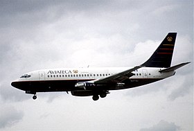
Aviateca flight 901
| Aviateca flight 901 | |
|---|---|
|
A Boeing 737-200 from Aviateca, similar to the plane that crashed |
|
| Accident summary | |
| Accident type | Controlled flight into terrain |
| place |
Chichontepec , El Salvador |
| date | August 9, 1995 |
| Fatalities | 65 |
| Survivors | 0 |
| Aircraft | |
| Aircraft type |
|
| operator |
|
| Mark |
|
| Departure airport |
La Aurora Airport , Guatemala City , Guatemala |
| Destination airport |
El Salvador Airport , San Salvador , El Salvador |
| Passengers | 58 |
| crew | 7th |
| Lists of aviation accidents | |
On August 9, 1995, on Aviateca flight 901 , a Boeing 737-2H6 Adv. With the aircraft registration number N125GU of Aviateca , with which a flight from Guatemala City to San Salvador was carried out, was flown against the volcano Chichontepec in El Salvador . All 65 people on board the machine were killed in the accident.
plane
The aircraft concerned was a Boeing 737-2H6 Adv., Which was finally assembled at the Boeing plant in Renton , Washington state and which made its maiden flight on September 26, 1987. The aircraft had the factory number 23849, it was the 1453. Boeing 737 from ongoing production. The machine was delivered brand new to Malaysia Airlines on October 8, 1987 , which put it into operation with the aircraft registration number 9M-MBM . From December 1993 the machine was leased by the ILFC to the TACA , which put it into operation on December 11, 1993 with the US aircraft registration N125GU . From June 1995 the CIT Group was the new lessor. The TACA for its part had leased the machine to Aviateca on January 1, 1994 . The twin- engined narrow -body aircraft was equipped with two Pratt & Whitney JT8D-15A engines. By the time of the accident, the machine had completed a total of 16,645 operating hours, which accounted for 20,323 take-offs and landings.
Passengers and crew
58 passengers had taken the international scheduled night flight from Guatemala City to San Salvador. There was also a crew of seven on board.
the accident
After a flight time of 20 minutes, the pilots contacted air traffic control at their destination, El Salvador International Airport. The air traffic controller informed them that there was a thunderstorm with heavy rain over the airport and instructed them to fly over the storm and make the approach against the wind direction and land on runway 07. However, the pilots and air traffic control were in disagreement about the position of the aircraft when the approach was initiated and the aircraft entered the bad weather front. The ground proximity warning system sounded at a height of 1,524 m . The pilots gave thrust to pull the machine up, but could no longer avert a collision. At 8:14 p.m. local time, the machine was flown into the flank of the Chichontepec volcano , exploded and went up in flames. All 65 people on board were killed.
root cause
The national aviation authority Dirección General De Transporte Aéreo investigated the accident. In her final report, she cited the pilots' lack of situational awareness of the obstacle in front of them as the likely cause of the accident, their decision to lower the aircraft below the safe altitude while deviating from the approach route, and the disagreement between air traffic control and the cockpit crew about the actual position of the machine, which led to the air traffic controller assigning the crew a flight level in which they could not fly over the obstacle.
The first officer's failure to address his concerns about the positions reported to the master in a more direct and urgent manner contributed to the accident. In this context, a generally deficient corporate policy at Aviateca with regard to crew resource management was also criticized. Furthermore, the failure of the air traffic controller to reconcile the reported position of the aircraft with regard to obstacles and to issue appropriate instructions and warnings.
swell
- Accident report 737-200, N125GU in the Aviation Safety Network
- Company history 737-200, N125GU on planespotters.net
Coordinates: 13 ° 35 '58.4 " N , 88 ° 50' 57.5" W.

