
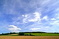
Bückeberg (Hagenohsen)

The Bückeberg is 160 m above sea level. NN high ridge south of Hameln , on the eastern edge of the Weser village Hagenohsen in the municipality of Emmerthal . It is located on the right, eastern bank of the Weser . The ridge and the other slopes of the Bückeberg are covered with mixed forest. From the village of Latferde further south, a district road leads over the Bückeberg to Hagenohsen.
history
During the National Socialist era, the annual " Reichserntedankfeste " took place on the north-western slope of the Bückeberg from 1933 to 1937 on a large, artificially leveled lawn . With up to a million participants, they were among the largest mass events of the National Socialists . Adolf Hitler gave propaganda speeches . The former grounds of the Reichserntedankfeste have largely been preserved. However, the remains of the stands for visitors and speakers were planted after 1945 and thus covered. There was no reference to National Socialist use.
In 2002 the municipality of Emmerthal designated the site as a residential area and planned to have it built on. The area has been a listed building since 2011 . Since 2016 there have been plans for a documentation and learning center on the former event site as a "historical-topographical information system". There is ongoing discussion about this. In 2017, the Hameln-Bad Pyrmont district council decided to set up a learning and documentation center for the use of the site during the Nazi era. The Lower Saxony Memorials Foundation and the Federal Government support the project conceptually and financially. A citizens' initiative in Emmerthal and the alternative for Germany in Lower Saxony reject it.
Bückeberg

Foundations of the former visitors' gallery above


Web links
- Wilhelm Gerntrup: The double Bückeberg. Deister and Weser newspaper , April 12, 2018
- The Bückeberg near Hameln - place of the Reichserntedankfeste 1933 to 1937/38
Individual evidence
- ↑ Rundblick Niedersachsen: Dispute about the Bückeberg: AfD rejects memorial at the former Nazi crime scene. Edition 125/2018, July 3, 2018
Coordinates: 52 ° 3 ' N , 9 ° 25' E