Babase
| Babase | ||
|---|---|---|
| Satellite image of the Feni Islands with Babase Island (center right). | ||
| Waters | Bismarcksee | |
| Archipelago | Feni Islands | |
| Geographical location | 4 ° 0 '42 " S , 153 ° 42' 37" E | |
|
|
||
| length | 10 km | |
| width | 5 km | |
| surface | 23 km² | |
| Highest elevation | 200 m | |
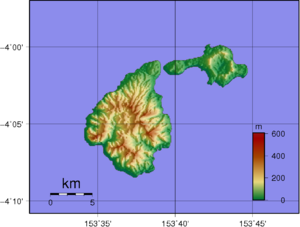
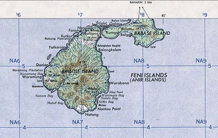
| Topographic map with Ambitle (larger) and Babase (smaller) | ||
Babase is the smaller and northern island of the Feni Islands in the Pacific , north of New Ireland in the Bismarck Archipelago , which belongs to Papua New Guinea , New Ireland Province . It is part of the Tabar - Lihir - Tanga - Feni island chain .
Babase is separated from the neighboring island of Ambitle by the Salat Street, which is only 100 m wide . In front of the Babase is the small side island Balum. Babase is about 23 km² and consists of a Pleistocene 200 m high stratovolcano and a lava dome , which are connected by a narrow isthmus .
On the island, near the village of Kamgot, there is an important archaeological site of the Lapita culture .


