Feni Islands
| Feni Islands | ||
|---|---|---|
| Satellite image of the Feni Islands | ||
| Waters | Bismarcksee | |
| archipelago | Bismarck Archipelago | |
| Geographical location | 4 ° 8 ′ S , 153 ° 42 ′ E | |
|
|
||
| Number of islands | 2 | |
| Main island | Ambitle , Babase | |
| Total land area | 110 km² | |
| Residents | 2000 | |
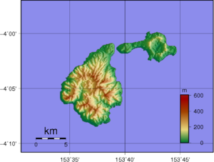
| Feni Islands topographic map . Ambitle is the western island | ||
The Feni Islands are an archipelago of two volcanic islands east of New Ireland in the Bismarck Archipelago , which belong to Papua New Guinea , New Ireland Province . They are part of the Tabar - Lihir - Tanga - Feni island chain .
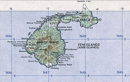
The largest island in the group is Ambitle (87 km²). The second island, Babase (23 km²), is separated from Ambitle by the 100 m wide Salat Strait . In front of the Babase is the small side island Balum.
The Feni Islands are also called Anir Islands , on old maps the names St. Jan, St. John, Wuneram, Wonneram or Bournand Islands are given.
The archipelago was discovered for Europe in June 1616 by Dutch navigators Jacob Le Maire and Willem Cornelisz Schouten . From 1885 to 1899 the Feni Islands belonged to the so-called " German Protected Area " and from 1899 to 1914 to the colony of German New Guinea , Neumecklenburg- Süd administrative district with its seat in Namatanai . In 1914 the islands were conquered by Australian troops, and after the First World War they were administered as a mandate of the League of Nations of Australia. Since 1975 they have been part of the independent state of Papua New Guinea.
The islands are hilly, rugged and rocky and densely forested. Although the last major volcanic eruption occurred 2300 years ago, there is still strong volcanic activity, especially on Ambitle, with numerous geysers , boiling mud pots and offshore hydrothermal vents .
A total of around 1,500 to 2,000 people live on both islands.
A gold deposit has been discovered on Ambitle that is geologically similar to the world-class porphyrical deposit of Bougainville and the largest porphyrical gold deposit in the world on Niolam ( Lihir Islands ).
literature
- Feni Islands . In: Heinrich Schnee (Ed.): German Colonial Lexicon . Volume 1: A - G. Quelle & Meyer, Leipzig 1920, p. 606.
Web links
- Feni Islands on oceandots.com ( Memento from December 23, 2010 in the Internet Archive )
Individual evidence
- ^ Behre Dolbear & Company, Inc .: Technical report on the Gold Potential at the Feni Islands. P. 6 ( Memento of October 8, 2007 in the Internet Archive ) (English, PDF; 4.2 MB)


