Bābolsar
| Bābolsar | ||
|---|---|---|
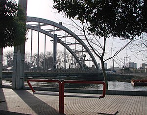
| Bridge in Bābolsar | ||
|
|
||
| Basic data | ||
| Country: |
|
|
| Province : | Māzandarān | |
| Coordinates : | 36 ° 42 ′ N , 52 ° 39 ′ E | |
| Height : | 23 m below sea level | |
| Surface: | 446 km² | |
| Residents : | 53,684 (2012) | |
| Population density: | 0 inhabitants per km² | |
| Time zone : | UTC +3: 30 | |
Bābolsar ( Persian بابلسر) is a city in the province of Māzandarān on the southern coast of the Caspian Sea near the mouth of the Bābol River . It is located 20 km north of Bābol and is surrounded by rice fields .
history
The city has had its current name since 1927, before it was known as Mashhad-e Sar . Since the middle of the 18th century, the urban port has gained in importance, but lost its commercial status after the reign of Reza Shah in favor of today's Bandar-e Torkaman (formerly Bandar-e Shah ). Since the end of the Second World War , the city has developed into an important seaside resort. Today the main faculties of the University of Māzandarān are located in Bābolsar .
sons and daughters of the town
- Abdollah Movahed (* 1940), wrestler
Web links
- Babolsar entry in the Encyclopædia Iranica (including references)
- photos

