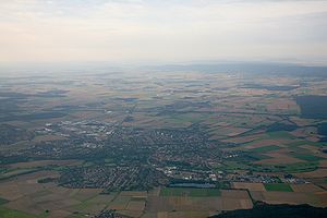
Wunstorf quarry pond
| Wunstorf quarry pond | ||
|---|---|---|

|
||
| Aerial view of Wunstorf seen from the north, with the quarry pond in the foreground, August 2007 | ||
| Geographical location | Wunstorf , Hanover region , Lower Saxony | |
| Data | ||
| Coordinates | 52 ° 25 '56 " N , 9 ° 25' 0" E | |
|
|
||
| surface | 3.2 ha | |
| length | 500 m | |
| width | 200 m | |
|
particularities |
Quarry pond |
|
The Wunstorf Baggersee is a quarry pond on the northern edge of Wunstorf in the Hanover region , Lower Saxony .
The lake is used by the sports fishing club Wunstorf eV as fishing waters. The fish stock includes carp , tench , pike , pikeperch , perch , eel , lake trout and lake char .
In addition, the quarry pond is used by Tauchsportclub Wunstorf eV for diving between the beginning of April and the end of October.
The lake is not known as a swimming lake. On the steep bank, the slopes keep slipping.
See also
Web links
Commons : Baggersee Wunstorf - Collection of pictures, videos and audio files
Individual evidence
- ^ SAV Wunstorf eV: Bagger-See (accessed on November 7, 2014)
- ^ Wunstorfer Stadtanzeiger from April 11, 2001
- ^ Wunstorfer Stadtanzeiger from March 6, 2010
