Balakun
| Balakun | ||
|---|---|---|
| height | 6471 m | |
| location | Uttarakhand ( India ) | |
| Mountains | Gangotri Group ( Garhwal Himalaya ) | |
| Dominance | 5.59 km → Chaukhamba I | |
| Notch height | 620 m | |
| Coordinates | 30 ° 46 '2 " N , 79 ° 20' 32" E | |
|
|
||
| First ascent | July 9, 1973 by the Indian-Tibetan border police | |
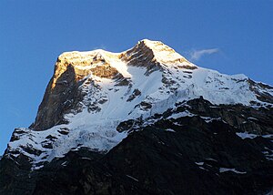
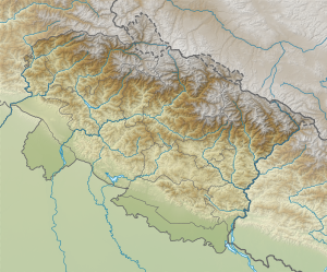
The Balakun is a 6471 m high mountain in the western Himalayas in the region Garhwal in the Indian state of Uttarakhand .
The balakun is located in the Chamoli district in the southeast of the Gangotri group in the western Garhwal Himalayas . The mountain lies in a ridge that runs between the Satopanth Glacier in the south and the Bhagirath Kharak Glacier in the north. The ridge continues to the west, where Chaukhamba I (7138 m), the highest peak in the Gangotri group, rises at a distance of 5.59 km .
The first ascent of Balakun was made by a group of six mountaineers from the Indian-Tibetan border police under the leadership of Hukum Singh on July 9, 1973.

