Bansagar dam
| Bansagar dam | |||||||||
|---|---|---|---|---|---|---|---|---|---|
|
|||||||||
|
|
|||||||||
| Coordinates | 24 ° 11 '23 " N , 81 ° 17' 15" E | ||||||||
| Data on the structure | |||||||||
| Lock type: | Gravity dam and earth embankment | ||||||||
| Construction time: | 1978-2006 | ||||||||
| Height above foundation level : | 67.5 m | ||||||||
| Crown length: | 405 m | ||||||||
| Power plant output: | 425 MW | ||||||||
| Data on the reservoir | |||||||||
| Altitude (at congestion destination ) | 341.64 m | ||||||||
| Water surface | 587.54 km² | ||||||||
| Reservoir length | 65 km | ||||||||
| Reservoir width | 16 km | ||||||||
| Total storage space : | 637 million m³ | ||||||||
| Catchment area | 18th 648 km² | ||||||||
| Design flood : | 47 742 m³ / s | ||||||||
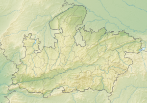
The Bansagar Dam is located in north central India on the river Son .
The dam is located 38 km south of the city of Rewa in the Shahdol district in the northeast of the state of Madhya Pradesh . It was built between 1978 and 2006. 336 villages were flooded. It is used for irrigation (2490 km² in Madhya Pradesh, 1500 km² in Uttar Pradesh and 940 km² in Bihar ) as well as energy generation (installed capacity of 425 MW) and drinking water supply.
Barrier structure and reservoir
The 587.5 km² reservoir is bordered by several dams and dams. A 67.5 m high and 405 m long gravity dam is located at the outflow of the Son. A 2.1 km long earth embankment runs along the north bank of the reservoir. There are also other smaller dams.
Web links
Commons : Bansagar Dam - collection of pictures, videos and audio files
Individual evidence
- ↑ National Register of Large Dams (PDF 9.3 MB) Central Water Commission. Archived from the original on August 20, 2014. Info: The archive link was inserted automatically and has not yet been checked. Please check the original and archive link according to the instructions and then remove this notice. Retrieved April 5, 2016.

