
Barajally
| Barajally | ||
|---|---|---|
|
Coordinates: 13 ° 36 ′ N , 14 ° 57 ′ W |
||
| Region: | Central River | |
| District: | Niani | |
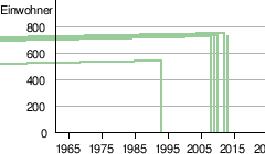
| Residents: | 726 (2013)
|
|
|
||

Barajally (written variant: Barajalli and Barajali , also Barajally Kunda and Barajally Suba ) is a town in the West African state of Gambia .
According to a calculation for 2013, around 726 people live there. The result of the last published census of 1993 was 656.
geography
Barajally is located on the north bank of the Gambia River in the Central River Region of the Niani District . The place, about 240 kilometers from the capital Banjul , is about 1.7 kilometers from the river bank, directly on the river is Barajally Tenda .
In 1985 the place of birth was declared a national monument by the former President Jawara .
The striking minaret of the local mosque can be seen from the river.
Sons and daughters of the place
- Dawda Jawara (1924–2019), Gambia's first president
See also
Individual evidence
- ↑ Barajally on bevoelkerungsstatistik.de (no longer available online, last accessed May 2013)
- ↑ Emma Gregg, Richard Trillo: The Rough guide to the Gambia = The Gambia. 2nd edition. Rough Guides, New York NY u. a. 2006, ISBN 1-84353-703-6