
Banjul
| Banjul | ||
|---|---|---|
 |
||
|
Coordinates: 13 ° 27 ′ N , 16 ° 35 ′ W |
||
| Region: | Greater Banjul Area | |
| Next place: | Serrekunda | |
| Surface: | 12 km² | |
| Founding: | 1816 | |
| Residents: | 31,356 (2013)
|
|

Banjul [ ˈbændʒuːl ] (until 1973 Bathurst ) is the capital of the West African state of Gambia . As the “City of Banjul”, the city in the Gambian administrative division belongs to the highest level of administrative units alongside the regions and Kanifing Municipal as a separate administrative district.
According to a calculation for 2013, around 31,356 inhabitants live there, making Banjul the eighth largest town in Gambia. The last published census of 2003 showed 34,828 inhabitants.
Popularly Banjul bears the nickname "City of Light".
geography
Geographical location
Banjul is located at the mouth of the Gambia River on the coast of the Atlantic Ocean . The settlement was built on a shallow sandbar island ( St. Mary's Island ) that had formed in the estuary over time. Before the settlement, bamboo forests grew on the sandbank in addition to baobabs ( baobabs ) .
Banjul means "bamboo island" in the Mande language .
Expansion of the urban area
Due to the geographical location on a sandbank , further expansion of the urban area is not possible; the mangrove swamps are located on the western city limits . These are known under the name Tanbi Wetland Complex and enjoy the special protection of a nature reserve and Ramsar reserve.
City structure
In addition to its function as the capital, the city of Banjul is also a separate administrative district of the state. Together with Kanifing Municipal , it forms the Greater Banjul Area .
Neighboring communities
As a rapidly growing city, Serekunda benefits from this natural boundary of the city . It is connected to Banjul by the Banjul-Serekunda Highway and lies west of the mangrove swamps on the mainland.
population
According to a survey from 1993 ( census at the time ), the Wolof make up the largest population group with a share of around three-tenths, followed by the Mandinka and the Fula. The distribution in detail: 31.1% Wolof , 28.9% Mandinka , 9.8% Fula , 8.1% Serer , 6.4% Diola , 5.9% Aku , 5.1% Serahule , 1.4 % Bambara , 1.1% Manjago and 2.5% other ethnic groups.
climate
| Banjul | ||||||||||||||||||||||||||||||||||||||||||||||||
|---|---|---|---|---|---|---|---|---|---|---|---|---|---|---|---|---|---|---|---|---|---|---|---|---|---|---|---|---|---|---|---|---|---|---|---|---|---|---|---|---|---|---|---|---|---|---|---|---|
| Climate diagram | ||||||||||||||||||||||||||||||||||||||||||||||||
| ||||||||||||||||||||||||||||||||||||||||||||||||
|
Average monthly temperatures and rainfall for Banjul
Source: wetterkontor.de
|
|||||||||||||||||||||||||||||||||||||||||||||||||||||||||||||||||||||||||||||||||||||||||||||||||||||||||||||||||||||||||||||||||||||||||||||||||||||||||||||||||||||||||||||||||||||||||||||||||||
history
In 1807, British colonialists began to colonize the island. In 1816, the city was founded as a trading and military post under the name Bathurst (after Henry Bathurst , Secretary of the British Colonial Bureau) when the British tried to curb the slave trade . Across from Fort Bullen ( Barra ) on the other side of the Gambia, they built a fort and several gun emplacements, including the Six-Gun Battery. Both forts were designed to prevent the continuation of the slave trade from the hinterland. The Six-Gun Battery has been classified as a UNESCO World Heritage Site since 2003 .
On February 18, 1965, the city became the capital of the newly independent state Republic of The Gambia . It was renamed Banjul on April 24, 1973 in the course of Africanization .

Bathurst 1824
The Albert Market

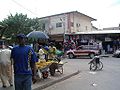
Street in Banjul


Population development
| year | Residents |
|---|---|
| 1963 | 27,809¹ |
| 1973 | 39,476¹ |
| 1983 | 44,188¹ |
| 1993 | 42,326¹ |
| 2003 | 34,828¹ |
| 2005 | 34,589 |
| 2006 | 34,388 |
| 2007 | 34,125 |
| 2008 | 33,820 |
| 2009 | 33,422 |
| 2010 | 32,921 |
| 2012 | 31,834 |
| 2013 | 31,356¹ |
¹ census result
Religions
Islam

The King Fahad Mosque , built in 1988, is Gambia's largest mosque. There are also other smaller mosques in the city, including the Masjid Abu Bakar Saddiq (previously Independence Drive Mosque ), the Masjid Umar Bun Khatab (previously Half-Die Mosque ) and the Masjid Ali Ibn Abi Talib (previously James Senegal Mosque ). The latter three were renamed by the Committee of Banjul Muslim Elders in June 2014. They should get a closer connection to Islam.
Christianity
The Roman Catholic Church maintains the diocese of Banjul for the almost 33,000 Catholics in Gambia .
politics
The city council ( Banjul City Council ) is headed by a Lord Mayoress , Rohey Malick Lowe has held this position since May 12, 2018 .
coat of arms
Description of the coat of arms:

|
The coat of arms originated in the British colonial times. Half moons and the cross of Lazarus symbolize the two religions Islam and Christianity, the cannons stand for the protection and security of the city and the wave arch stands for the river Gambia with its abundance of fish (fish).
Town twinning
- Dakar , Senegal
- Doha , Qatar (2011)
- Freetown , Sierra Leone , since 2008
- Grimsby , UK
- Milan , Italy (2008)
- Newark , United States
- Taipei , Republic of China (Taiwan)
- Tuskegee , United States
- Unna , Germany (without formal consolidation)
Culture and sights
Museums
- The National Museum on Gloucester Street displays exhibits from the colonial past and recent history of The Gambia.
Buildings

The city's architecture is still largely colonial. A post-colonial exception is the 35-meter-high Arch 22 , which was inaugurated on the 2nd anniversary of the coup on July 22, 1994. From the triumphal arch on Independence Drive , which is also the symbol of Banjul and the whole country, one has a good overview of the city.
Regular events
- Banjul is the target of an unusual annual car race, the Banjul Challenge . Entrants must drive a car that is no more than £ 100 in value and be on a budget when traveling. Based on the Paris-Dakar rally , the vehicles from Plymouth in southern England are expected to reach the north-west coast of Africa in just under twenty days. If they arrive, the vehicles will be sold or donated.
- Similar to the above Banjul Challenge, the Dresden-Dakar-Banjul Challenge takes place twice a year. This is organized by the Saxon Latitude eV It starts in March and October, used cars are driven, which, when they arrive at their destination, are auctioned for charity.
Economy and Infrastructure
The seaport of Banjul plays an important role for Gambia. The most important export product is peanuts , the main imports are oil and petroleum products.
In a ranking of cities according to their quality of life, Banjul ranked 185th out of 231 cities worldwide in 2018.
traffic
Banjul can be reached from the west of the mainland via the well-developed Banjul-Serekunda Highway , which runs over Denton Bridge , and Bond Street. To the east there is the Banjul – Barra ferry service , which runs every ninety minutes to Barra on the other side of the river.
Outside of Banjul, i.e. no longer in the urban area of Banjul and about 24 kilometers away, is the Banjul International Airport .
Personalities
- Honorary Citizen of Banjul
- 2008 - Michael Fennell , Commonwealth Games federation
- 2008 - Father Joseph Gough (1944-2017)
See also
Individual evidence
- ↑ Banjul on bevoelkerungsstatistik.de (no longer available online, last accessed May 2013)
- ↑ Banjul: The City of Light ( Memento from August 10, 2016 in the Internet Archive ) The Daily Observer from December 31, 2014
- ^ Population by Ethnicity, by Settlement and Local Government Area. (Gambians Only) ( Memento from November 13, 2012 in the Internet Archive ) PDF file
- ↑ Three mosques renamed in Banjul ( Memento of July 14, 2014 in the Internet Archive ) The Daily Observer (online) of June 26, 2014
- ↑ Capitals of the World, flags and emblems , accessed August 2012
- ↑ Banjul signs twining pact with Doha ( Memento of July 14, 2014 in the Internet Archive ) The Daily Observer (online) of October 28, 2011
- ↑ News. Freetown City Council, March 21, 2009. ( December 17, 2009 memento in the Internet Archive )
- ↑ BCC Twin With Milan City Council The Point (online) of November 20, 2008
- ↑ Peter JM Nas, Timoer Reijnders, Eline Steenhuisen: Three Harbor Cities: An Exploration of the Ports of IJmuiden (the Netherlands), Banjul (the Gambia) and Jakarta (Indonesia). In: Arndt Graf, Beng Huat Chua (Ed.): Port Cities in Asia and Europe (= Routledge studies in the modern history of Asia (2005). Vol. 54). Routledge, London / New York NY 2009, ISBN 0-7103-1183-4 , pp. 33-56, here p. 46.
- ↑ Mercer's 2018 Quality of Living Rankings. Retrieved August 18, 2018 .
- ↑ citoidWikitext * NO TITLE PROVIDED. In: thepoint.gm. Retrieved March 25, 2019 .
- ↑ Honorary Citizenship Conferred on Fri Gough. In: thepoint.gm. December 31, 2008, accessed March 24, 2019 .
Web links
City of Banjul | Kanifing Municipal (→ GBA ) and the regions: West Coast | Lower River | North Bank | Central River | Upper River