
Barkla (moon crater)
| Barkla | ||
|---|---|---|

|
||
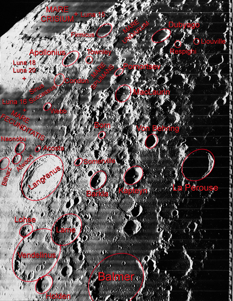
| Barkla (center) and surroundings ( LROC -WAC) | ||
|
||
| position | 10.65 ° S , 67.2 ° E | |
| diameter | 41 km | |
| depth | 2910 m | |
| Card sheet | 80 (PDF) | |
| Named after | Charles Glover Barkla (1877-1944) | |
| Named since | 1979 | |
| Unless otherwise stated, the information comes from the entry in the IAU / USGS database | ||

Barkla is an impact crater near the eastern edge of the Earth's moon . It lies east of the striking Langrenus crater and west of the Kapteyn crater, which is approximately the same size . In the southwest is the Lamé crater .
The crater rim of Barkla forms an almost perfect circle except for slight bulges in the northeast and southwest. The crater walls show only minor traces of erosion from later impacts. In the center of the crater floor rises a central summit, from which low ranges of hills extend to the south and northeast.
Individual evidence
- ^ John Edward Westfall: Atlas of the Lunar Terminator. Cambridge University Press, Cambridge 2000, ISBN 0-521-59002-7 , p. 270
Web links
- Barkla in the Gazetteer of Planetary Nomenclature of the IAU (WGPSN) / USGS
- Barkla on The-Moon Wiki
- Barkla crater in the "Digital Lunar Orbiter Photographic Atlas of the Moon"
