Batangas Bay
| Batangas Bay | ||
|---|---|---|
| Waters | Isla Verde Street | |
| Land mass | Luzon | |
| Geographical location | 13 ° 43 ′ N , 120 ° 59 ′ E | |
|
|
||
| surface | 220 km² | |
| Medium water depth | 200 m | |

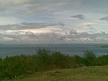
View of the Batangas Bay from Brgy. Pagkilatan, Batangas City
The Batangas Bay is a mostly landlocked bay in the province of Batangas in the southwest of the island of Luzon , the Philippines . It is a sea bulge in the north of the Isla Verde Strait and extends from the coast of Batangas City to the Calumpang Peninsula , on which the 501 meter high Panay volcano lies. The bay covers an area of 220 km², with an average depth of 200 meters.
The most important port in the bay is the deep water port of Batangas City, from which ferry connections to Puerto Galera are offered.
Web link
- the Batangas region on the Pemsea.org website (PDF file; 9.59 MB)
