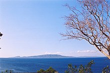
Isla Verde Street
| Isla Verde Street | ||
|---|---|---|
| Connects waters | South China Sea | |
| with water | Sibuyan lake | |
| Separates land mass | Luzon | |
| of land mass | Mindoro | |
| Data | ||
| Geographical location | 13 ° 33 ' N , 120 ° 59' E | |
|
|
||
| length | 100 km | |
| Smallest width | 20 km | |
| Coastal towns | Batangas City , Puerto Galera | |
The Isla Verde Strait is a strait in the Philippines that separates the islands of Luzon and Mindoro .
It connects the southwestern part of the South China Sea with the Sibuyan Sea and is an arm of the sea on which shipping traffic between Manila and the port cities in the Visayas and Mindanao regions and between Batangas City and Puerto Galera is handled. In the estuary are the islands of Verde and Maricaban , both of which are popular tourist destinations. To the north of the Isla Verde Strait are the bays of Batangas and Balayan . The two bays are separated by the Calumpang Peninsula , on which the 501 meter high Panay volcano is a striking landmark for shipping. The Calatagan Peninsula marks the western exit of the sea route . In the northwest of the strait are the Lubang Islands and the less busy Calavite Strait .
The island of Verde and the strait are named after Captain Juan Verde, who subjugated the Batangas region for the Spanish crown in the 16th century , which at the time was named Balayan de Kumintang .
Isla Verde Street is considered a biodiversity hot spot worldwide. More than 300 different types of corals and more than 1000 different types of fish have been recorded in the strait. The hawksbill sea turtle , the olive hybrid turtle , the dark giant grouper ( Epinephelus lanceolatus ) and the rare giant clams have also been found in the straits.

