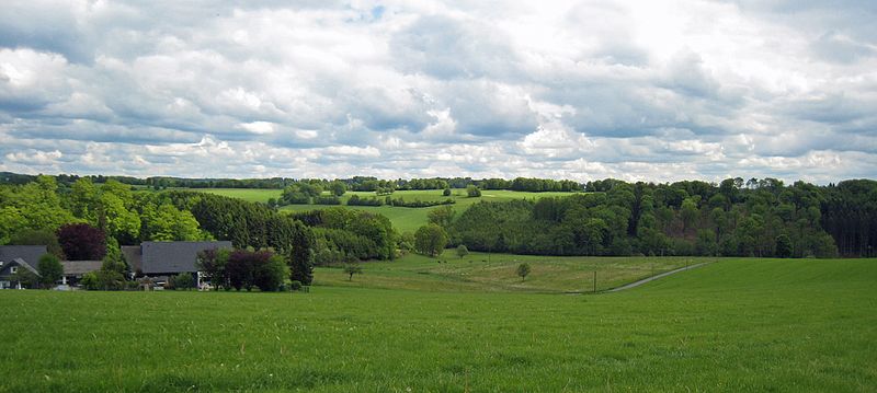
Bergerhöhe (Kürten)
The Bergerhöhe is a mountain range in the south in the municipality of Kürten in the Rheinisch-Bergisches Kreis between the creek valleys of the Kürtner Sülz and its tributary Altenbach . The Riedel extends in the area between Meiersberg in the west, the former Kahlenberg in the north, Nassenstein in the east and Kuddenberg in the south. Until 1975 the ridge belonged to the rural community of Olpe .
In terms of nature, the Bergerhöhe is part of the Kürten plateau .
It has not been proven where the name Bergerhöhe comes from. In any case, it has been popularly formed over the years and has long since entered common usage. As can be seen from the topographical survey of the Rhineland from 1824, the Bergerhöhe lies in the area of the Altbergic mountain range . As a result, the name may have contributed to the name Bergerhöhe , because it was intended to specifically address the altitude. It is also noteworthy that most places on the Bergerhöhe end on a mountain , such as Meiersberg, Gerhardsberg , Johannesberg , Kuddenberg and the desolate Kahlenberg. The name Bergerhöhe probably comes from the time of the Berg Honschaft .
A golf course was created on the Bergerhöhe at the end of the 1980s. The local golf club has the name Bergerhöhe in its name.
Individual evidence
- ↑ a b Street names of the municipality of Kürten - place and hamlet names, No. 3, p. 25. Retrieved on May 30, 2017 .
- ↑ Handbook of the natural spatial structure of Germany: Sheet 108/109: Düsseldorf / Erkelenz (Karlheinz Paffen, Adolf Schüttler, Heinrich Müller-Miny) 1963; 55 p. And digital version of the corresponding map (PDF; 7.4 MB)
- ↑ Maps of the Rhineland under v. Müffling 1824-1825
- ^ Golf-Club Kürten eV Bergerhöhe, accessed on May 22, 2017
Coordinates: 51 ° 4 ′ N , 7 ° 17 ′ E
