Olpe (Kürten)
|
Olpe
Kurten municipality
Coordinates: 51 ° 2 ′ 40 ″ N , 7 ° 17 ′ 15 ″ E
|
||
|---|---|---|
| Incorporation : | 1st January 1975 | |
| Postal code : | 51515 | |
| Area code : | 02268 | |
|
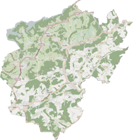
Location of Olpe in Kürten |
||
|
former rectory and former town hall
|
||
The parish village of Olpe with its 45 hamlets and courtyards is the south-eastern district in the municipality of Kürten in the east of the Rheinisch-Bergisches Kreis , about 25 km east of Cologne.
history
Olpe was first mentioned in a document in 1171. Archbishop Philipp von Heinsberg (1167–1191) confirmed in a letter that a Reinald von Olpe ( Reinaldum de Olpe eiusque uxor Kunigunde ) had several farms and a mill in Blankenberg on the victory found, sold to the nunnery St. Ursula in Cologne . Until the dissolution of the Bergische Ämter around 1808, Olpe belonged to the Bergisch Amt Steinbach . In the course of the Napoleonic takeover of the Grand Duchy of Berg , the parish Olpe became the Mairie Olpe in 1810 and this belonged to the canton of Wipperfürth in the Elberfeld arrondissement . In 1816 the Grand Duchy came to Prussia after the Congress of Vienna . Mairie Olpe became the Olpe mayor in the Wipperfürth district . In 1927 this became the Olpe office.
After the Second World War, Olpe came to the office of Kürten together with Bechen and Wipperfeld. The history of Olpe over the past 30 years has been characterized by three features:
- Territorial reform of 1974/75,
- brisk construction activity and
- Structural change in agriculture.
For centuries, the inhabitants of the parish village of Olpe lived exclusively from agriculture and forestry. That has changed in the last few decades. Medium-sized companies and many craft businesses settled here. Due to its proximity to the city of Cologne, many commuters made Olpe a popular place to live in the countryside.
At the beginning of the 20th century the following houses / buildings stood in Olpe
- House Olpe / Burg Olpe with outbuildings, year of construction is not known
- Gasthof Robert Höller with ancillary building (today "Alter Olper Hof") built in 1816
- Gasthaus Haasbach (today "Haus Olpe"), built in 1821
- Mayor's office, later the rectory, built in 1907
- Vicarie in Wiedenhof, built around 1865
- Haasbach shop, built before 1896
- School, expanded in 1909
- Parish Church of St. Margareta, built in 1896
The village was expanded in four construction phases:
The first phase of construction began opposite the church in the early 1970s, today the streets Am Buchenwald and Burgstraße. 30 prefabricated houses were built. These streets are popularly called "Chipboard Hills".
The 2nd construction phase is located in the "Hofwiese". New houses were built here from 1981 to 2006. The street name was derived from the field name.
The third village expansion took place on the "Glockenberg" above the cemetery. These houses were built from 1993 to 2004 on a former orchard. Some of the fruit trees have been preserved in the gardens. The name Glockenberg (High German for "Glockenmich") goes back to an old legend according to which the bells were buried there during the Thirty Years' War (1618–1648) in order to protect them from being melted down for cannons. Nothing was found in the development.
The second street on the Glockenberg is called “An der Pasche”. This name refers to the Haasbach family's herb factory. The "Pasche" (apple press) with cabbage factory was located on the current parking lot of the Haasbach restaurant and at Olpetalstrasse 4 until the mid-1930s.
The last extension for the time being is in the east of the village on the parcel "Ober dem Hofe". Renewable energy technologies are also considered when designing these homes. Because of the colorfulness of the individual houses, one speaks of the “parrot settlement”.
The population of the civil parish of Olpe has been in the past until today:
- 1829: 1448 inhabitants
- 1925: 1457 inhabitants
- 1946: 2216 inhabitants
- 1953: 2077 inhabitants
- 2006: 2294 inhabitants
Incorporation
On January 1, 1975, the Olpe community ceased to exist. The main part with an area of 19.86 km² with 2253 inhabitants at that time was incorporated into the municipality of Kürten. Lindlar received 60 hectares with 52 inhabitants at the time.
Economy and landscape
Olpe , a church village away from the main traffic routes, is referred to as the green heart of the large municipality of Kürten and in many writings as the gem of the Bergisches Land . The village itself is surrounded by many smaller, self-contained districts as well as hamlets and farms. Most of the municipal area is used for agriculture and forestry.
See also
Individual evidence
- ↑ Martin Bünermann, Heinz Köstering: The communities and districts after the municipal territorial reform in North Rhine-Westphalia . Deutscher Gemeindeverlag, Cologne 1975, ISBN 3-555-30092-X .
literature
- Josef Büchel: 825 years of Olpe in the Bergisches Land , a village chronicle.


