Broich (Dorpe)
|
Broich
Kurten municipality
Coordinates: 51 ° 0 ′ 38 ″ N , 7 ° 12 ′ 1 ″ E
|
||
|---|---|---|
| Postal code : | 51515 | |
| Area code : | 02207 | |
|
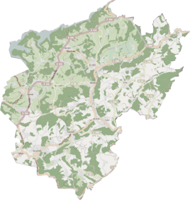
Location of Broich in Kürten |
||
|
The house shown was first attached to the old Broich farm, then the farm was demolished.
|
||
Broich is a residential area in the municipality of Kürten in the Rheinisch-Bergisches Kreis . The place is now part of the larger district of Dorpe and no longer perceptible as an independent settlement.
Location and description
Broich is located west of the church village Dürscheid on the southwestern edge of the district Dorpe on the city limits to Bergisch Gladbach . The place can be reached via the street Dicker Busch , which branches off from the state road 286. It emerges from one of the numerous scattered settlements that were located in this area and which in the course of time condensed into an almost closed settlement area. Other places in the area are Spitze , Bölinghoven , Trotzenburg , Unterthal and the abandoned mine Grube Luther .
Broich lost its independent location towards the end of the 20th century when the Dorpes settlement area grew to the residential area.
history
The place name is a -bruch -name, meaning a boggy, swampy place.
The Topographia Ducatus Montani by Erich Philipp Ploennies , Blatt Amt Porz , shows that the residential area had a courtyard as early as 1715, which is labeled as a break . From the chart of the Duchy of Berg from 1789 by Carl Friedrich von Wiebeking it is clear that the place was part of the Dürscheid Honschaft at that time in the Bensberg Higher Court of the Bergisch Office of Porz .
The place is recorded on the topographical survey of the Rhineland from 1824 as a Broche . The Prussian first photo from 1845 shows the residential area unlabeled as part of the Dorpe settlement area. From the Prussian new admission in 1892, the place is regularly recorded as Broich on measuring table sheets .
Under the French administration between 1806 and 1813, the Porz office was dissolved and the Dürscheid parish , to which Broich also belonged, was politically assigned to Mairie Bensberg in the Mülheim am Rhein arrondissement . In 1816 the Prussians converted the Mairie to the mayor's office in Bensberg in the Mülheim am Rhein district . In 1845 Broich had nine residents of Catholic faith.
The municipal and Gutbezirksstatistik the Rhine Province leads Broich 1871 with three houses and 14 residents. In the list of the Kingdom of Prussia for the 1885 census, Broich near Dürscheid was listed as a place to live in the rural community of Bensberg in the Mülheim am Rhein district. At that time, three houses with 10 residents were counted. In 1895 the place has a house with five inhabitants and belongs to the Catholic parish of Dürscheid, in 1905 one house and four inhabitants are given.
Due to the Cologne Act , the municipality of Kürten was merged with the previously independent municipalities of Bechen and Olpe and parts of the city of Bensberg to form the municipality of Kürten with effect from January 1, 1975 . Broich also became part of the municipality of Kürten.
Individual evidence
- ^ Heinrich Dittmaier : settlement names and settlement history of the Bergisches Land . In: Journal of the Bergisches Geschichtsverein . tape 74 , parallel edition as a publication by the Institute for Historical Regional Studies of the Rhineland at the University of Bonn. Schmidt, Neustadt ad Aisch 1956.
- ^ Wilhelm Fabricius : Explanations for the Historical Atlas of the Rhine Province ; Second volume: The map of 1789. Division and development of the territories from 1600 to 1794 ; Bonn; 1898
- ↑ Overview of the components and list of all the localities and individually named properties of the government district of Cologne: by districts, mayor's offices and parishes, with information on the number of people and the residential buildings, as well as the Confessions, Jurisdictions, Military and former state conditions. / ed. from the Royal Government of Cologne [Cologne], [1845]
- ^ The communities and manor districts of the Rhine Province and their population. Edited and compiled by the Royal Statistical Bureau from the original materials of the general census of December 1, 1871. In: Königliches Statistisches Bureau (Hrsg.): The communities and manor districts of the Prussian state and their population. tape XI , 1874, ZDB -ID 1467523-7 ( digitized ).
- ^ Community encyclopedia for the province of Rhineland. Based on materials from the census of December 1, 1885 and other official sources, edited by the Royal Statistical Bureau. In: Royal Statistical Bureau (Hrsg.): Community encyclopedia for the Kingdom of Prussia. tape XII , 1888, ZDB -ID 1046036-6 ( digitized version ).
- ^ Community encyclopedia for the province of Rhineland. Based on materials from the census of December 1, 1895 and other official sources, edited by the Royal Statistical Bureau. In: Royal Statistical Bureau (Hrsg.): Community encyclopedia for the Kingdom of Prussia. tape XII , 1897, ZDB -ID 1046036-6 .
- ^ Community encyclopedia for the Rhine Province. Based on the materials from the census of December 1, 1905 and other official sources, edited by the Royal Prussian State Statistical Office. In: Königliches Prussisches Statistisches Landesamt (Hrsg.): Community encyclopedia for the Kingdom of Prussia. Booklet XII, 1909, ZDB -ID 1046036-6 .

