Unterthal (Bergisch Gladbach)
|
Unterthal (Bergisch Gladbach)
City of Bergisch Gladbach
Coordinates: 51 ° 0 ′ 41 ″ N , 7 ° 11 ′ 34 ″ E
|
||
|---|---|---|
|
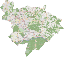
Location of Unterthal (Bergisch Gladbach) in Bergisch Gladbach |
||
Unterthal is a district in the Herrenstrunden district of Bergisch Gladbach .
history
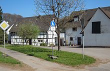
Unterthal emerged from an early modern settlement that was first mentioned in 1685 as Unterdall . The estate was given the name Unterthal in 1694 to distinguish it from neighboring Oberthal . By 1905, the original farm estate had developed into a hamlet with six residential buildings and 43 residents. The basic word Thal refers to the topographical location in a valley.
Individual evidence
- ^ Andree Schulte, Bergisch Gladbach, city history in street names , published by the Bergisch Gladbach city archive, volume 3, and by the Bergisches Geschichtsverein department Rhein-Berg e. V., Volume 11, Bergisch Gladbach 1995, p. 193, ISBN 3-9804448-0-5

