Oberthal (Bergisch Gladbach)
|
Oberthal (Bergisch Gladbach)
City of Bergisch Gladbach
Coordinates: 51 ° 0 ′ 56 ″ N , 7 ° 11 ′ 52 ″ E
|
||
|---|---|---|
|
Location of Oberthal (Bergisch Gladbach) in Bergisch Gladbach |
||
|
Farm in Oberthal with linden tree.
|
||
Oberthal is a district in the Herrenstrunden district of Bergisch Gladbach .
Location and description
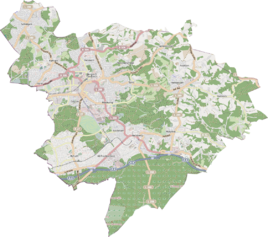
Oberthal is located in the north of Bergisch Gladbach on a cul-de-sac going north from Unterthal in the headwaters of the Strunde . The municipality borders Odenthal to the north and west and Kürten to the east . The location essentially consists of a courtyard.
history
The Oberthal farm was probably built during the Franconian construction period (9th / 10th century). In the original cadastre , the settlement was first mentioned in 1520 under the name Zum Dall with three houses. The name Oberthal was given to the estate in 1694 to distinguish it from the neighboring Unterthal . According to a lease from 1520, the Johanniterkommende Herrenstrunden owned the facility. At the end of the 17th century, the farm owned 100 acres . In addition, the lease from 1692 shows 9 acres of farmland, 41 acres of arable land and 49 acres of coppice and scrubland. In 1806 the court fell into state ownership with the secularization . It has been privately owned since October 7, 1829.
Natural monument
In Oberthal in front of the courtyard there is a lime tree that characterizes the landscape and is listed as particularly worthy of protection in the list of natural monuments in the Rheinisch-Bergisch district .
Individual evidence
- ^ Andree Schulte: Bergisch Gladbach, city history in street names . Published by the Bergisch Gladbach City Archives, Volume 3, and by the Bergisches Geschichtsvereinteilung Rhein-Berg e. V., Volume 11, Bergisch Gladbach 1995, ISBN 3-9804448-0-5 , p. 188 f.


