
Square mill
| Square mill
|
||
|---|---|---|
 Platzmühle in Gangelt-Stahe |
||
| Location and history | ||
|
||
| Coordinates | 50 ° 59 '10 " N , 6 ° 1' 43" E | |
| Location | Germany | |
| Waters | Rodebach | |
| Built | around 1472 | |
| Shut down | 1926 cessation of grinding operations | |
| technology | ||
| use | Oil, wage and grain mill | |
| Grinder | 4 tampers 1 grind | |
| drive | Watermill | |
| water wheel | undershot | |

The Place Mill is a former on Rodebach preferred water mill with an undershot waterwheel in Gangelt -Stahe, a rural community in North Rhine-Westphalia Heinsberg district .
geography
The Platzmühle is located at Zur Platzmühle 22, in the Stahe district in the Gangelt community. The area on which the courtyard and mill building stands is approx. 59 m above sea level . The mill on the right side of the stream on the upper reaches is the second of fourteen mills. Above was the Engelsmühle , below is the Mohrenmühle .
Waters
The Rodebach supplied fourteen mills with water until the 20th century. The stream begins at a retention basin near Siepenbusch in the town of Übach-Palenberg at an altitude of 105 m above sea level. The Rodebach has a length of 28.9 km to its confluence with the Geleenbeek near Oud-Roosteren in the Netherlands . The mouth height is 29 m above sea level. The care and maintenance of the Rodebach and its tributaries is subject to the respective neighboring cities and communities.
history
The square mill is referred to in the Gangelter Stadtbuch in 1472 as a Schlagmühle and in 1723 in a legal dispute as a Schlagoligsmühle. These old names indicate that this was an oil mill . According to information provided by the current owners, the mill burned down in 1809. In the 19th century, presumably when the mill was rebuilt, its use was changed. It worked as a tan mill with four pounders and one grinding gear that was used alternately. In 1926 the milling operation was stopped. Reasons were for a decline in water levels and secondly, the amelioration of Staher fracture.
gallery

Courtyard and farm buildings
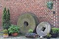
Stoneware from old mill times

Tranchot card 1804/05


literature
- Hans Vogt: Lower Rhine water mill guide 2nd edition. Niederrhein Association, Krefeld 1998, ISBN 3-00-002906-0 , pp. 240–241.
- State survey office of North Rhine-Westphalia topographic map 1:50 000 L 5102 Geilenkirchen and L 5000 Selfkant, ISBN 3-89439-417-X
Web links
At the worm :
Beeretz mill |
Bommers Mill |
Frelenberger Mill |
Horriger Mill |
Hünshovener oil mill |
Grinder and Oil Mill Trips |
Marienthaler Mill |
Müllendorfer mill |
Lohmühle |
Lohmühle |
Eichenthal Mill |
Mill Hommerschen |
Oil and paper mill Oberbruch |
Porselener Mill |
Randerather oil mill |
Rimburg mills |
Süggerather mill |
Interrupt mill |
Full mill interruption |
Zweibrügger Mühle
An der Junge Wurm:
Aldenhover Mühle |
Brünkers Mill |
Dahlmühle |
Horster mill |
Karker Mill |
Kemper Mill |
Lambertz Mill |
Liecker mill |
Powder mill ] |
Schafhausen grain mill |
Schafhausen oil mill |
Town mill |
Valley mill |
Wolfhager Mühle
Am Rodebach :
Brommler Mühle |
Dahlmühle |
Angel Mill |
Etzenrather mill |
Ingentaler Mill |
Isenbruch Mill |
Istrater mill |
Tüddern grain mill |
Millener mills |
Mohrenmühle |
Square mill |
Vollmühle Tüddern |
Wehrer Mühle
An der Schwalm :
Bischofsmühle |
Post mill |
Kornmühle Tüschenbroich |
Kringsmühle |
Lohmühle |
Neumühle |
Oil mill Tüschenbroich |
Rossmühle |
Wegberger Mühle
Am Mühlenbach :
Buschmühle |
Holtmühle |
Meismühle |
Molz mill |
Schrofmühle
Am Helpensteiner Bach:
Dalheimer Mühle |
Helpensteiner Mill |
Rödgener Mühle
Am Beeckbach :
Ophover Mühle
Am Kitschbach :
Kitscher Mühle
Am Knippertzbach :
Knippertzmühle
Am Uebach :
Übacher Mühle