
Uebach
| Uebach | ||
 The Uebach flows into the Wurm |
||
| Data | ||
| Water code | DE : 282872 | |
| location | District of Heinsberg , North Rhine-Westphalia , Germany | |
| River system | Rhine | |
| Drain over | Wurm → Rur → Maas → Hollands Diep → North Sea | |
| River basin district | Meuse | |
| source | Eisenbahnstrasse, Alsdorf 50 ° 52 ′ 35 ″ N , 6 ° 8 ′ 24 ″ E |
|
| Source height | approx. 150 m above sea level NN | |
| muzzle | Near In der Schley, Übach-Palenberg Coordinates: 50 ° 55 '42 " N , 6 ° 5' 41" E 50 ° 55 '42 " N , 6 ° 5' 41" E |
|
| Mouth height | approx. 81 m above sea level NN | |
| Height difference | approx. 69 m | |
| Bottom slope | approx. 7.6 ‰ | |
| length | 9.1 km | |
| Catchment area | 16.117 km² | |
The Uebach is a right tributary of the Wurm in the river system Wurm- Rur - Maas in the city of Übach-Palenberg , in the North Rhine-Westphalian district of Heinsberg , in the administrative district of Cologne .
history
The Uebach is the eponymous body of water of the former municipality of Übach and today the first name of the city of Übach-Palenberg. In addition to the main source, it was also fed by a few secondary sources. The Uebach also had a few other names. He was also called Herbach , Mühlenbach , Palenbach or de Bäek . Only the coal mining ensured that the natural Uebach disappeared. Mountain Technical faults of mine Adolf ensured that the sources were becoming weaker and finally dried up in the early 1930s. The Carolus-Magnus mine in Übach-Palenberg used the stream for mine waste water.
description
The former small brook had its sources between Merkstein and Alsdorf at a height of about 150 m above sea level . In the 20th century in particular, the Uebach was an important body of water for the people of Übach. In May 1982 the Übach district was hit by a flood of the century . The water rose to over 1.40 m on the market square and so it was decided to undertake extensive expansion work. Today it ekes out more of a existence than a receiving water or makes its river bed available for treated sewage . In built-up areas, the Uebach is partially piped. The stream flows into the Wurm near Marienberg on the right-hand side at a height of around 81 m above sea level. The water association Eifel-Rur (WVER) is responsible for the care and maintenance of the water .
Watermills on the Uebach
In the Middle Ages , the Uebach drove two water mills , according to a document from 1231. It cannot be ruled out that next to the mill at the Mühlenbach manor , a second mill was temporarily in operation at the Weyenberg knight seat in the earliest times .
gallery

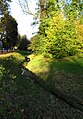
The Uebach valley near Plitschard

The course of the brook in the Übach district
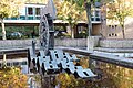
The developed Uebach

Worm bridge near the mouth of the Uebach

Information board for the Übacher mill
Memory of the Übacher mill


literature
- Hans Vogt: Lower Rhine water mill guide 2nd edition. Niederrhein Association, Krefeld 1998, ISBN 3-00-002906-0 , pages 282.
- Peter Jansen: In search of the old origins of the Übach and its tributaries Heimatkalender Selfkantkreis Geilenkirchen-Heinsberg 1962, page 63 ff.
Web links
Individual evidence
- ↑ a b German basic map 1: 5000
- ↑ Topographical Information Management, Cologne District Government, Department GEObasis NRW ( Notes )
- ↑ Area directory for the water stationing map of the state of North Rhine-Westphalia ( Memento of the original from October 17, 2013 in the Internet Archive ) Info: The archive link was inserted automatically and has not yet been checked. Please check the original and archive link according to the instructions and then remove this notice. (PDF; 556 kB)
- ↑ http://www.wver.de/