
Worm (rur)
| worm | ||
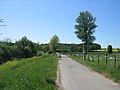
 Two mills on the Wurm between Rimburg Castle (D) and Rimburg (NL) |
||
| Data | ||
| Water code | EN : 2828 | |
| location | Germany | |
| River system | Rhine | |
| Drain over | Rur → Maas → Hollands Diep → North Sea | |
| River basin district | Meuse | |
| source | south of Aachen 50 ° 44 ′ 15 ″ N , 6 ° 5 ′ 16 ″ E |
|
| Source height | 265 m above sea level NN | |
| muzzle | north of Heinsberg in the Rur coordinates: 51 ° 5 ′ 52 ″ N , 6 ° 6 ′ 23 ″ E 51 ° 5 ′ 52 ″ N , 6 ° 6 ′ 23 ″ E |
|
| Mouth height | 32 m above sea level NN | |
| Height difference | 233 m | |
| Bottom slope | 4.1 ‰ | |
| length | 57 km | |
| Catchment area | 355.518 km² | |
| Discharge at the Randerath A Eo gauge: 310.52 km² Location: 13.76 km above the mouth |
NNQ MNQ 1966-2017 MQ 1966-2017 Mq 1966-2017 MHQ 1966-2017 HHQ |
1.131 m³ / s 1.743 m³ / s 3.382 m³ / s 10.9 l / (s km²) 25.538 m³ / s 35.678 m³ / s |
| Big cities | Aachen | |
| Medium-sized cities | Geilenkirchen
Heinsberg |
|
 River basin of the Rur with the course of the Wurm |
||
The Wurm ( Dutch Worm ) is a 53 kilometer long tributary of the Rur in the Euregio Meuse-Rhine . It is named for the former worm area , which made up part of the Aachen coal mine .
Surname
The worm is said to have got its name from the Celts who settled in the Aachen basin . It is explained as a derivation of the word warm , which refers to the thermal springs from which the worm partly feeds (see also derivation of the city name of Würselen ). However, there is no conclusive evidence for this derivation.
Another possible explanation is an old European education with m- suffix to Indo-European * uer- , * our- with the meaning of water, rain, river .
geography
course
The worm rises from the source horizon at the foot of the Düsbergkopf , an elevation in the Aachen forest , south of Aachen , near the B 57 at Steinebrück (Diepenbenden), and flows north into the Aachen basin. From their sources to approximately 260- 280 m above sea level. NN runs the worm with an average flow rate of 1.4 m³ / s down to Rur , in which after 53 kilometers north of it Heinsberg m at Kempen at a height of only 32 opens above sea level. The water depth there is about one meter and the width about eight meters. The catchment area above ground is around 354 square kilometers. The Eifel-Rur Water Association (WVER) is responsible for the Wurm .
Aachen basin


The worm rises on the northern slope of the Aachen forest south of Aachen in the Aachen urban area near Steinebrück (Diepenbenden) and flows northwards, down into the Aachen basin. At the northern end of the Soers , the Wurm is the only drain that leaves the Aachen basin. The Aachen Forest is an altitude level in the transition area from the North German Plain ( Cologne Bay ) to the Rhenish Slate Mountains ( Eifel ). It forms part of a watershed , waters originating on its southern slope flow over the Göhl directly west to the Maas , while the waters originating on the northern slope flow north over the Wurm and Rur to the Meuse.
In the urban area of Aachen there are more than 20 thermal water sources with an outlet temperature of over 50 ° C, in Burtscheid up to 74 ° C. As early as Roman times , part of the Wurm creek water was channeled above the source area of the Burtscheider thermal springs ( Kalter Bach ) and directed past the thermal springs to ensure the fresh water supply for the settlement in the Aachen boiler. The natural stream in the deepest part of the Burtscheider valley absorbed the waste water from the thermal springs and was called the warm stream . In later times, the cold worm water was extremely important for the Aachen and Burtscheider cloth production , which required a lot of soft water. This water could only be taken from streams that were not "contaminated" with thermal water, as it was too hard due to the high content of minerals and carbonates and unusable for some work steps. In the city archive of Aachen there are many historical documents with which the water was justly regulated at the Wurm and other streams, whereby the cloth manufacturers received the lion's share. The cold and warm brooks only unite below the northeasternmost Burtscheider spring outlets in the Frankenberg district.
In the area of the Aachen basin, the Wurm takes in the majority of the other Aachen brooks, including the Beverbach , the Gillesbach, the Kupferbach, the Predigerbach, the Goldbach and the Paubach (all flowing south and east of the Aachen city center) as well as the Kannegießerbach , the Johannisbach and the Haarbach . This makes the worm the receiving water of the Aachen basin and the natural flow of the cold and warm streams that flow together in the Aachen basin.
Since the middle of the 18th century the Wurm was canalized under Aachen. In today's Aachen city area, parts of the Wurm are only close to the source and south of the Haaren district, around from Europaplatz on the surface of the earth. Incidentally, the stream runs from Burtscheid, where it already runs underground, for example along Bachstrasse, Brabantstrasse, Kongressstrasse, Aretzstrasse, Talstrasse to Europaplatz. To the north of Europaplatz, the Wurm reappears, passes Gut Kalkofen , Haaren and the Soers and reaches the Wurmtal there. Shortly before it left the Aachen city area, extensive renaturation measures took place in 2009–2010. The Wurmtal is a kerbsohlental that cuts into the areas north of Aachen with some very steep slopes. In this area the Wurm has many meanders , especially in the Wurmtal between Würselen and Herzogenrath .
Wurmtal nature reserve


In the area of the cities of Würselen and Herzogenrath, the Wurmtal nature reserve, which is also used as a local recreation area, lies on both sides of the Wurm . South of the city of Herzogenrath, it is approx. 445 hectares in size and is shaped in large parts by the freely swaying river meanders of the Wurm in the open, often agriculturally used floodplain. In the Würselen area on the eastern edge of the Wurmtal are the ecologically valuable White Halde (limestone residues from the soda industry) and the Black Halde, which originates from coal mining and has interesting dry flora. In Würselen-Morsbach there is the tunnel mouth of the former Gouley pit (coal), which drains into the worm. The Wurmtal was designated as a nature reserve as early as 1989. The Wurmtal nature reserve north of Herzogenrath is only about 19 hectares in size. The Wurm flows there as an unobstructed lowland river in a white willow forest. There are also corresponding information boards (nature trail) with lots of information about the worm and the natural landscape it has influenced.
The unspoilt valley area of the Wurm is sometimes only a few hundred meters wide and the buildings in the settlements often reach right up to the often wooded slopes. The Wurm, with its weed-rich shorelines, has an ecologically significant wealth of structures due to the many steep bank breaks and landings. Overhanging edges and wide landings covered with gravel and rubble mark the course of the worm.
Because of the small-scale ecosystems shaped by the gravel and sand landings of the worms, the water has a particularly attractive effect on certain, sometimes rare bird species such as the common sandpiper , the sandpiper , the snipe and the water pipit . The rare kingfisher , which occurs as a breeding bird in the Wurmtal and Amstelbachtal , also finds ideal nesting opportunities in the edge of the Wurm's bank edge. As a strongly structured natural area, the Wurmtal clearly stands out from the surrounding, cleared bordering landscape with high settlement density and is therefore of supraregional importance for migrants and wintering birds as well as a habitat for a large number of sometimes rare, sometimes threatened animal and plant species.
By decision of the North Rhine-Westphalian state government, the worm valley from Herzogenrath upstream in June 1998 and downstream from Herzogenrath in 2000 was reported to the European Union as a Fauna-Flora-Habitat (FFH) area. This protects the natural landscape and the small-scale ecosystems it contains.
Downstream or north of Herzogenrath, the Wurmtal opens up gradually, the valley slopes become increasingly flatter and the difference in altitude to the surrounding area decreases significantly.

worm

Former watermill near Zweibrüggen

Schloss Trips near Geilenkirchen
Course of the worm at Süggerath


Course in the Heinsberg district

.jpg)
The Wurm temporarily leaves German territory as a border river between Herzogenrath and Übach-Palenberg . In Rimburg this "Intermezzo" ends and the worm continues to flow to Marienberg and Frelenberg over after Geilenkirchen . It then passes Randerath and soon afterwards reaches the Rur valley and the urban area of Heinsberg . Behind the Kempen district, the Wurm finally flows into the Rur after about 57 kilometers .
Inflowing streams

After leaving the Aachen basin up to its confluence with the Rur, the worm absorbs the water from the following streams:
|
Stat. in km |
Surname | GKZ | location | Length in km |
EZG in km² |
Mouth |
|---|---|---|---|---|---|---|
| 55.915 | Worm (Arm Luttitz) | 2828 112 | Left | 1.002 | 0.998 | ? |
| 56.015 | Wormarm SO | 2828 1192 | Left | 0.337 | ? | ? |
| 56.061 | NN | 282811932 | Left | 0.047 | ? | ? |
| 55,409 | Kupferbach | 2828 12 | right | 2.146 | 2.846 | ? |
| 54.345 | Goldbach | 2828 14 | Left | 1.218 | 2.042 | ? |
| 52.398 | Gillesbach | 2828 152 | right | 3,638 | ? | ? |
| 52.163 | Beverbach | 2828 16 | right | 9.045 | 12,334 | ? |
| 51,335 | Paubach | 2828 18 | Left | 4,146 | 9,927 | ? |
| 49,308 | Huettenbach | 2828 194 | right | 2,599 | ? | ? |
| 48.417 | Haarbach | 2828 2 | right | 9.488 | 15.99 | ? |
| 47.554 | Rethelsiefen | 2828 3122 | right | 0.958 | ? | ? |
| 47,483 | Talbotbach | 2828 3124 | Left | 0.483 | ? | ? |
| 46,418 | Torrent | 2828 32 | Left | 5.312 | 19.674 | ? |
| 45.535 | Meisbach | 2828 34 | right | 1,597 | 2.658 | Würselen |
| 45.207 | Umfluter Wolfsfurth | 2828 392 | Left | 0.462 | ? | ? |
| 38.038 | NN | 2828 396 | Left | 1.205 | ? | ? |
| 35.679 | Dog passing on | 2828398 | Left | 0.932 | ? | ? |
| 34.967 | Broicher Bach | 2828 4 | right | 8,252 | 41.091 | Herzogenrath |
| 30.821 | Amstelbach | 2828 6 | Left | 13,892 | 44,534 | Eygelshoven , Kerkrade |
| 26,342 | Uebach | 2828 72 | right | 9,061 | 16.117 | Übach - Palenberg - Marienberg |
| 15.635 | Ditch Zumdahl | 2828 74 | Left | 1.138 | 3,614 | ? |
| 15.011 | Leerodter ditch | 2828 76 | Left | 3,188 | 0.332 | ? |
| 14,894 | Beeckfliess | 2828 8 | right | 13,294 | 57.575 | Geilenkirchen - Flahstrasse |
| 14.386 | Nirmer Graben | 2828 912 | Left | 1.178 | ? | ? |
| 11.819 | Horster tipping ditch | 2828 914 | Left | 1.689 | ? | Heinsberg- Horst |
| 9.034 | Küppers ditch | 2828 92 | Left | 2.081 | 2,795 | ? |
| 7.044 | Kötteler crowd | 2828 94 | Left | 9.498 | 21,968 | ? |
| 5.155 | Worm (branch) | 2828 952 | right | 1.082 | ? | ? |
| 3,921 | Vongenlaaker Bach | 2828 96 | Left | 2.108 | 1.501 | ? |
| 1.297 | A + B trench 1 | 2828 98 | right | 1.791 | 3.823 | ? |
In addition, the Linnicher Mühlenteich (also called Teichbach on maps, from the connection point to the Wurm also called Erlenbach) at Hückelhoven- Hilfarth has a connection to the Wurm and a temporary water discharge into the Wurm or vice versa, depending on the water level. The Linnicher Mühlenteich then flows into the Rur a little later (in maps as Erlenbach). In addition, numerous discharges of wastewater treated in sewage treatment plants from the settlements on both sides of the Wurm are certainly partly responsible for certain structures. This explains, for example, that despite the essentially stable precipitation in the Aachen area, the Wurmtal showed clear signs of increased deep erosion , especially in the later 20th century . This can only be explained on site by increased water flow, but not as a result of increased precipitation and the resulting larger runoff volumes, as these did not change significantly. Most of the water that is used in the Aachen area is reservoir water from the Eifel, which would never have got into the Wurm before. Now, however, tens of thousands of cubic meters are consumed every day, cleared and fed into the worm at various points, directly or indirectly via flowing streams. This can be seen particularly well downstream of the sewage treatment plant in the Aachen Soers, which is probably the most important discharger of treated wastewater into the Wurm.
Hydrography
Aachen is located on the northern edge of the Eifel , which is part of the Rhenish Slate Mountains . With westerly winds statistically predominant in Central Europe, this means that if the total precipitation is slightly above average, there is generally enough precipitation to permanently supply the worms with sufficient water. Particularly in the case of continuous rain and thunderstorms, which hit the Aachen area and thus the low mountain range threshold due to north or north-westerly air currents, the damming effect can cause particularly heavy and persistent precipitation. These then flow away in bulk over the Wurm and led or lead to floods again and again both in the Wurmtal north of Aachen and on the lower reaches near Geilenkirchen. In the past, attempts were made to influence this situation through river straightening, bank regulation and fortifications between Herzogenrath and the confluence with the Rur in Kempen. The flood situation on the lower reaches was temporarily improved, but for decades the Wurm looked like a canal in this section. In order to at least partially reverse this, the Wurm has been renatured again since 2006 between Übach-Palenberg and Geilenkirchen in a winding, but artificially dug stream bed .
The worm is allowed to squirm again. This is what a press release from February 25, 2013 in the Aachener Zeitung reads about the renaturation of a 400 m long stretch of the Wurm in the area of the Zweibrügger mill. Between the districts of Palenberg and Zweibrücken, the Wurmtal recreation area is located on both sides of the water . Archaeological traces of Roman settlement in the Wurmtal are also revealed and can be viewed here. In the city center of Geilenkirchen, like in Aachen, the Wurm is completely overbuilt over a distance of around 300 meters. In October 2017, another section of the route near Trips Castle was renatured to a length of 840 m. The old, meandering worm bed was exposed and the canalized worm tied and filled in. In the course of the measure, two bicycle and pedestrian bridges were also built. ( See picture )
Two gauges are operated on the Wurm in Herzogenrath and Randerath to measure the water level. At the Herzogenrath gauge, the mean water level (MW) is 66 cm. The mean high water level is 207 cm, high water level 3 is 240 cm. On April 30, 2018, the flood reached the 300 cm mark. (July 2014 it was 285 cm) Parts of the city center were flooded. In Randerath the mean water level (MW) is 95 cm. The mean high water level (MHW) is 250 cm; on July 10, 2014, around 285 cm was reached.
Water quality

The Wurm transported the urban, long-untreated sewage of Aachen and other Dutch and German neighboring communities. As a result, the water quality of the worm was extremely poor for a long time. For a long time, the worm also absorbed the pit water and partly also the waste water from the coal washes of neighboring mines in the Wurmrevier as well as some Dutch mines in the Kerkrade area. Orally it has been passed down that the sludge that remained in the lower reaches of the river after flooding was stabbed and burned by the population in the war and first post-war years because of its coal content. In times of low precipitation, the worm was still often black in the lower reaches of the 1960s and caused unpleasant smells. The discharges of coal mining have come to a standstill due to its decline, however, and the sewage from the neighboring cities and municipalities is for the most part cleared before being discharged into the Wurm. A total of 15 German and Dutch wastewater treatment plants discharge their treated wastewater into the Wurm. In dry times, the worm water consists of up to 90 percent treated wastewater. Due to the improved water quality, pike , eel , chub and perch are currently found again in the worm . As a neozoon, the goldfish has also been spotted in the worm.
Nevertheless, the worm and its tributaries are exposed to a wide variety of environmental pollution and the condition is (as of 2008) in some places unsatisfactory. For the nationwide uniform implementation of the European Water Framework Directive (WFD), the water landscape in North Rhine-Westphalia was divided into twelve sub-catchment areas on the basis of the above-ground catchment areas, which belong to the four river areas of the Rhine, Weser, Ems and Maas.
For the implementation of the Water Framework Directive in the sub-catchment area Rur and other southern Maas tributaries, the Cologne district government was appointed as the lead office (project management). A milestone in the implementation to date is the preliminary water management inventory, which is documented as the “Results report for the Rur and other southern Maas tributaries”.
In 2009 the public took part in the draft of the management plan and the program of measures. The results of the investigation programs, the existing water uses and achievable management objectives were presented in the management plan. The program of measures provides the framework for the necessary improvements in the next few years.
history
Border river
The Wurm forms the border river to Kerkrade and Landgraaf in the Netherlands between Herzogenrath and Übach-Palenberg . The border is not the stream line or the middle of the river, but the eastern or right bank of the Wurm. The river therefore flows in this section on Dutch territory.
From the Middle Ages to the 19th century, the Wurm formed the border between the then independent towns of Geilenkirchen and Hünshoven . It was also the border line between the dioceses of Cologne and Liège at that time .
Also in the late Middle Ages and at the time of the Aachen Empire , the Wurm was part of the outer ring of the Aachener Landgraben in the section from the Wolfsfurt mills to the Bardenberger Mühle and in the area of Bardenberg and Herzogenrath border river between the duchies of Brabant (west of the Wurm) and Jülich ( east of the worm). In particular, Wilhelmstein Castle , but also Rode Castle , were at least temporarily in the function of border fortifications and toll castles . With the Siegfried Line , the National Socialists built another border fortification that also touched the Wurmtal. In the area of the Wurmaue between Würselen-Bardenberg and -Pley and between Herzogerath- Straß, there are still remains of the dragon's teeth ( anti- tank barriers) as well as blown bunkers and gun emplacements.
Settlement and structures

A first settlement of today's city center of Aachen took place on a hill within the swampy Aachen basin. The Aachen basin was a damp swamp and crossed by numerous rivers and streams, including certainly several dozen warm and hot springs. Precipitation caused further water entry. The natural course of the basin was the Wurmbach. Before the settlement of the Aachen basin, the young Wurmbach carried significantly less water, as there were no discharges from industrial and sewage water, and was a river. In the times of the Celts the source was in today's Burtscheid. The spring was dedicated to the Celtic god Grannus and a. an invaluable asset! One would never leave the sacred source area of the hot spring to z. B. to use colder water below in the course of the water. However, the sources of the worm were relocated "uphill" by diverting cold water (from a river in the source region assumed today) in order to be able to use it at all.
The Romans continued to use this constellation of water and expanded Aachen as a “bath”. However, the now increasing settlement required dry areas. It can be assumed that the course of the river was relocated several times on the slopes of today's urban forest.
Numerous mills, hammer mills, dye works, grinding shops, cloth manufacturers and other factories used the water of the Wurm and its inlets as the driving force for their grinding mills and machines in later centuries. For this new purpose, a new laying of the tile was made to keep the water z. B. to save a use in mill ponds.
Even in today's Heinsberg district, a mill stream was branched off between Nirm and Randerath as early as 800 AD , which was called Junge Wurm (also Jonge Worm ). This canal led via Randerath, Horst , Porselen , Dremmen , Hülhoven , Schafhausen through Heinsberg to Lieck , and drove a total of twelve mills in its course , with a total gradient of 26 meters. At Lieck, at the height of the Liecker mill, it flowed into the Liecker Bach, also called Stadtbach, and led over Karken to the Netherlands . The stream bed was partially elevated and was used to flood (water) the surrounding pastures and fields.
During the heavy bombing raids on Heinsberg on November 16, 1944 ( Operation Clipper , Geilenkirchen was occupied on November 19 ), the stream bed near Heinsberg was destroyed and, given the progressive electrification of the mills, was not rebuilt. The stream was filled in, many of which were built over and is no longer recognizable today.
The map on the right shows that the Wurm flowed into the Rur above Oberbruch near Krickelberg in the 16th century.

At the Wurm there are numerous mills and other buildings worth seeing, for example the Hochbrücker Mühle in Aachen, the Adamsmühle, the Alte Mühle and the Pumpermühle in Würselen , the Rimburger Mühle and the Zweibrüggener Mühle in Übach-Palenberg, the Geilenkirchener Mühle and the Tripser Mill in Geilenkirchen and the Porselener mill in Heinsberg.
Castles and palaces along its route are Wilhelmstein Castle in Würselen- Bardenberg , Rode Castle in Herzogenrath , Rimburg Castle and Zweibrüggen Castle in Übach-Palenberg, Trips Castle , Gut Leerodt and Gut Kleinsiersdorf in Geilenkirchen, Gut Zumdahl in Kogenbroich and Haus Honsdorf in Honsdorf.

literature
- Günter Kalinka (text), Jakob Schütten (illustrations): Naturraum Wurmtal. Wurmverlag, Herzogenrath 1993
- Dieter Berger: Duden Geographical Names in Germany. Origin and meaning of the names of countries, cities, mountains and bodies of water (Duden pocket books; 25). Dudenverlag, Mannheim 1999, ISBN 3-411-06252-5 (EA Mannheim 1993).
- Christof Peter, Franz Meiers, Gabi Heidner, Gabi Hermsdorf, Hartmut Welters, Henry Beierlorzer and Rita Caesar: Securing evidence. Walks along the Aachen brooks , February 1983, page 105 ff. ("Die Wurm"), library of the Burtscheid Society for Past and Present .
- Luise Freiin von Coels von der Brügghen: The streams and mills in the Aachen empire and in the area of the imperial abbey of Burtscheid . In: Zeitschrift des Aachener Geschichtsverein , Volume 70 (1958), p. 5 (48 ff.), ISSN 0065-0137
Individual evidence
- ↑ a b German basic map 1: 5000
- ↑ a b Topographical Information Management, Cologne District Government, Department GEObasis NRW ( Notes )
- ^ Randerath gauge
- ↑ Archive link ( Memento from June 22, 2015 in the Internet Archive )
- ↑ Water directory of the State Office for Nature, Environment and Consumer Protection NRW 2010 (XLS; 4.67 MB) ( Notes )
- ↑ Specialized information system ELWAS, Ministry for Climate Protection, Environment, Agriculture, Nature and Consumer Protection NRW ( information )
- ↑ http://www.aachener-zeitung.de/lokales/heinsberg/die-wurm-darf-sich-wieder-mehr-iegen-1.526169
- ↑ Time series for the measuring point. Retrieved August 28, 2018 .
- ↑ Herzogenrath - The flood of April 30th evokes memories in Herzogenrath. Retrieved August 28, 2018 .
- ↑ Land under in Herzogenrath . In: THW OV Herzogenrath . ( thw-herhabenrath.de [accessed November 6, 2018]).
- ↑ State Office for Nature, Environment and Consumer Protection North Rhine-Westphalia: The worm level in Randerath , July 10, 2014.
- ↑ Neozoa - or how does the goldfish get into the worm? on: rheinischer-fischereiverband.de , November 28, 2006.
Web links
- Wasserverband Eifel-Rur (WVER): The worm
- The worm: lifeline and eco-niche , Aachener Zeitung from January 14, 2013
- River areas NRW: Profiles for the Maas-Süd (Rur) area , from p. 110 "Wurm" planning unit (PDF file; 11.47 MB)
- River basins of North Rhine-Westphalia: The renaturation of the Wurm near Übach-Palenberg
- Histor. City map Aachen and Burtscheid 19th century with course of the worm
- The worm level in Herzogenrath