
Broicher Bach
| Broicher Bach | ||
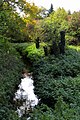
 Spring area retention basin in Linden-Neusen |
||
| Data | ||
| Water code | DE : 28284 | |
| location | Germany | |
| River system | Rhine | |
| Drain over | Wurm → Rur → Maas → Hollands Diep → North Sea | |
| River basin district | Meuse | |
| source | District Linden-Neusen , City of Würselen 50 ° 50 ′ 16 ″ N , 6 ° 10 ′ 31 ″ E |
|
| Source height | 174 m above sea level NN | |
| muzzle | City area Herzogenrath in the Wurm Coordinates: 50 ° 52 '2 " N , 6 ° 6' 38" E 50 ° 52 '2 " N , 6 ° 6' 38" E |
|
| Mouth height | 106 m above sea level NN | |
| Height difference | 68 m | |
| Bottom slope | 8.2 ‰ | |
| length | 8.3 km | |
| Catchment area | 41.091 km² | |
| Drain at the mouth |
MNQ MQ |
79.37 l / s 299.15 l / s |
The Broicher Bach is a right-hand brook in the Wurm - Rur - Maas river system in the North Rhine-Westphalian city region of Aachen in the administrative district of Cologne .
geography
course
The sources of the Broicher Bach with a height of 174 m above sea level are now located in a rain retention basin between the streets In der Dell and Holzweg in the Linden-Neusen district of the city of Würselen. The creek with a length of 8.2 km is a tributary of the Wurm and flows to the north in a westerly direction through the area of the city of Alsdorf and then to the city of Herzogenrath. In the road area An der Wurm / Apolloniastraße the Broicher Bach flows into the Wurm at a height of 106 m above sea level at km 35.0. A reservoir , located about 500 meters above the mouth in the Broichbachtal recreational area, regulates the flow of water from the Broich Bach into the Wurm. The water association Eifel-Rur (WVER) is responsible for the care and maintenance of the water .
Tributaries
- Siefengraben (GKZ 282842) ( right ), 2.5 km
- Euchener Bach (GKZ 282844) ( left ), 2.0 km
- Schleibach (GKZ 2828452) (left), 2.8 km
- Birker Bach (GKZ 282846) ( left ), 3.7 km
- Ruifer Bach (GKZ 282848) ( left ), 2.3 km
history
The Broicher Bach is a centuries-flowing waters that to form the Broichbachtal between Broicher settlement and Herzogenrath has contributed significantly and led to an early settlement by humans. Numerous mills contributed to the livelihood of the population living here and shaped nature and life. Today the Broichbachtal recreational area with a total size of 86.4766 hectares is designated here.
Watermills on the Broicher Bach
A number of former watermills stand or stood by the Broich Bach :
- Broicher Mühle in Alsdorf-Broich, Broicher Mühle
- Kranentalsmühle in Alsdorf, Kranentalsmühle
- Kellersberger Mühle in Alsdorf, Dorfstrasse 4
- Left mill in Alsdorf, Würselener Straße 65
- Alsdorf oil mill in Alsdorf, Würselener Straße
- Roman mill in Herzogenrath- Noppenberg , Römergasse
- Berger mill in Herzogenrath-Noppenberg, Am Erlenbruch
- Erckensmühle in Herzogenrath, Dammstrasse
→ See also the list of mills on the Wurm
gallery

Mill pond at the Broicher mill
Stream course below the Broicher Mühle
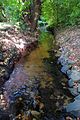
Water course above the Kranentalsmühle

Kahnweiher in Alsdorf
Course of the water at the Roman mill

Water fountain on the Broicher Bach
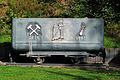
Memories of "old times"

Broicher Bach below the Alsdorf oil mill

Memorial stone of the Berger Mühle
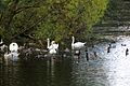
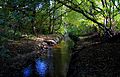
Bird life at the Broicher Bach

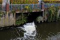
Weir for flood regulation

Reservoir in front of the city of Herzogenrath

Reservoir with dam in Herzogenrath
The Broicher Bach flows into the Wurm


literature
- Hans Vogt: Lower Rhine water mill guide 2nd edition. Niederrhein Association, Krefeld 1998, ISBN 3-00-002906-0 , p. 269
Web links
- Nature Conservation Association Aachen
- Euregio in the picture
- Watermills on the worm ; Section: Watermills on the Broicher Bach
- The Broichbachtal , in Wolfgang Voigt: Nature in Alsdorf - a natural history walk
Individual evidence
- ↑ a b German basic map 1: 5000
- ↑ Topographical Information Management, Cologne District Government, Department GEObasis NRW ( Notes )
- ↑ Area directory for the water stationing map of the state of North Rhine-Westphalia ( Memento of the original from October 17, 2013 in the Internet Archive ) Info: The archive link was inserted automatically and has not yet been checked. Please check the original and archive link according to the instructions and then remove this notice. (PDF; 556 kB)
- ↑ ELWAS card
- ↑ http://www.wver.de/
- ↑ Water directory for the water station map of the state of North Rhine-Westphalia (PDF; 1.1 MB)