Broich settlement
|
Broich settlement
City of Alsdorf
Coordinates: 50 ° 51 ′ 0 ″ N , 6 ° 11 ′ 0 ″ E
|
|
|---|---|
| Height : | 176 m |
| Area : | 4.01 km² |
| Residents : | 2800 (25 Aug 2007) |
| Population density : | 698 inhabitants / km² |
| Postal code : | 52477 |
| Area code : | 02404 |
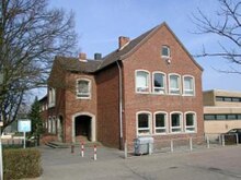
The Broich settlement is a southern district of Alsdorf in the Aachen city region near the municipal border with Würselen . In the north, the Alsdorf district of Mariadorf borders the Broich settlement. The settlement has a sports field, a kindergarten and a community elementary school as well as a multi-purpose hall. The Catholic Church is called St. Barbara and offers space for meetings next to the church in the parish hall. In the northwest, the settlement borders directly on the “Broicher Weiher” recreation area , from where the Alsdorfer Weiher zoo can be reached on forest paths . Both are parts of the Broichbachtal recreational area and can be reached through nature by bike or on foot. Northeast of the settlement before Broicher Blumenrath is a conservation area .
history
In 1934 the first families of miners moved into the Ley settlement (later “Broichweiden IV”) along Blumenrather Strasse . The drafts for the elementary school with forecourt on Grabenstrasse and the adjoining communal buildings, which were not erected, come from architecture professor Otto Gruber , who, together with Hans Mehrtens and René von Schöfer, specifically involved the RWTH Aachen Faculty of Architecture in settlement planning in Alsdorf in order to protect the National Socialist State the usefulness of the university. The name ' Broich settlement' arose from its proximity to the Broichweiden district of Broich in the south . The residents of the Broich settlement decided to belong to the city of Alsdorf. Broichweiden and Broich were incorporated into Würselen on January 1, 1972, and the Broich settlement was reclassified to Alsdorf according to the wishes of the population. In postal terms, the Broich settlement was "Broichweiden 4" until 1971. In 2014 a new village square was created in the area in front of the primary school, where a public boules alley has been available since 2015.
traffic
The next junctions are Alsdorf and Broichweiden on the A44 . You can also use the access point on the L136 for trips to Aachen. The next Euregiobahn stops have been Alsdorf-Mariadorf and Alsdorf-Poststraße since December 2011. In addition to the place of residence, the federal highway 1 (B1) runs from Aachen to Berlin. The nearest long-distance train stations are Herzogenrath station on the Aachen – Geilenkirchen – Mönchengladbach line and Eschweiler Hauptbahnhof on the Aachen – Düren – Cologne line .
Web links
Individual evidence
- ^ Moritz Wild: Architecture and urban planning in the administrative district of Aachen. René von Schöfer (1883-1954) . Michael Imhof-Verlag, Petersberg 2019, pp. 71–74, 115–117.
- ^ Federal Statistical Office (ed.): Historical municipality directory for the Federal Republic of Germany. Name, border and key number changes in municipalities, counties and administrative districts from May 27, 1970 to December 31, 1982 . W. Kohlhammer, Stuttgart / Mainz 1983, ISBN 3-17-003263-1 , p. 305 .


