
Haarbach (worm)
| Haarbach | ||
 The Haarbach flows into the Wurm at the Tuchmacherweg in Haaren |
||
| Data | ||
| Water code | DE : 28282 | |
| location | North Rhine-Westphalia , Germany | |
| River system | Rhine | |
| Drain over | Wurm → Rur → Maas → Hollands Diep → North Sea | |
| River basin district | Meuse | |
| source | City of Aachen , Forst district, at the former Driescher Hof 50 ° 45 ′ 5 ″ N , 6 ° 8 ′ 43 ″ E |
|
| Source height | 231 m above sea level NN | |
| muzzle | City of Aachen, Haaren district in the Wurm Coordinates: 50 ° 47 ′ 5 ″ N , 6 ° 7 ′ 20 ″ E 50 ° 47 ′ 5 ″ N , 6 ° 7 ′ 20 ″ E |
|
| Mouth height | 144 m above sea level NN | |
| Height difference | 87 m | |
| Bottom slope | 6.4 ‰ | |
| length | 13.5 km | |
| Catchment area | 15.99 km² | |
The Haarbach is a right-hand brook in the Wurm - Rur - Maas river system in the city of Aachen in the North Rhine-Westphalian city region of Aachen in the administrative district of Cologne .
history
The Haarbach is a centuries-flowing waters , which even today for field drainage in the Aachen basin is needed. With the settlement of the rivers and streams , the people of the Haarbach increasingly used water power to operate water mills in suitable locations through damming and natural slopes . Several buildings and the Welsche Mühle still provide evidence of this era in the Aachen area.
After repeated floods in the center of Aachen- Haaren , where the Haarbach flows into the Wurm, a rain retention basin was built below the Kahlgrachtmühle in the early 1970s and the flow was limited.
Bach description
In earlier times the sources of the Haarbach were at a height of approx. 231 m above sea level near the former Driescher Hof in the Aachen- Forst district . Today the brook begins near Gut Neuenhof. The stream with an original length of almost 9 km is a tributary of the Wurm and flows northeast in the direction of Eilendorf , passing under the Aachen- Eschweiler railway line at the Nirm district . The further path of the creek runs in a north-westerly direction, south past Verlautenheide and then bends to the south-west and flows through the retention basin and the Haarbachtal. In this flatter area shortly before the development line of Haaren, the stream was originally able to meander freely . In 1987, excessive safety measures for a power pole, a bridge foundation and a hiking trail resulted in the stream continuing to follow several meander arcs, but these are now fixed with large stones and many specially planted trees. In the city center of Haaren, the Haarbach is largely canalized. On the Tuchmacherweg, the Haarbach flows into the Wurm as an open stream at a height of about 144 m above sea level. The water association Eifel-Rur (WVER) is responsible for the care and maintenance of the water .
Renaturation
In large parts of its course, the Haarbach flows through an artificial stream bed. These sometimes unsightly and unnatural concrete profiles are now being dismantled by the water association in some places in order to restore the stream bed to a condition that is as natural as possible and to upgrade it ecologically. In 2015, a 380 m long straightened section of the stream was rebuilt at great expense in Eilendorf above the Kahlgracht mill. The new, strongly curved route extended the Haarbach here by 190 m. In 2016, in the area of Nirmer Platz in Eilendorf, the green area through which the Haarbach flows will be chamfered and a floodplain will be created.
Tributaries from the Haarbach
- Freunder Bach with a length of 2.0 km
- Brander Bach with a length of 1.4 km
- Deltourserb receiving water course with a length of 0.5 km
- Rödger Bach with a length of 4.3 km
- Ellerbach with a length of 0.7 km
gallery
The Haarbach in its beginnings

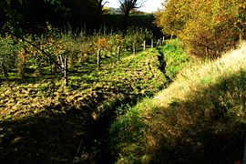
After a short distance, the Haarbach supplies a wetland
Artificial stream bed in Eilendorf-Nirm

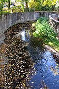
The Haarbach below the Kahlgrachtmühle
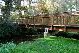
Bridge crossing at the Haarbach
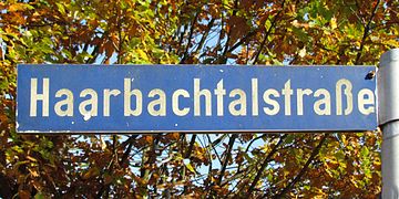
Street name on the Haarbach
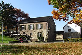
The Welsche Mühle near the Haarbach


Watermills on the Haarbach
At the Haarbach there are or were some water mills :
- Harner Mühle near the Haarhof, Debyestrasse
- Nirmer Mühle in the Nirm district, Schuttenhofweg 232
- Scheidmühle in the Nirm district, Zur Scheidmühle
- Kahlgrachtmühle In Aachen-Haaren, Kahlgrachtstrasse 54
- Welsche Mühle in Aachen-Haaren, Mühlenstrasse 19
literature
- Erich Mertes • Daniel Heidenbluth • Peter Bertram: Mühlen der Eifel Volume II, Die Nordeifel, 2005, ISBN 3-938208-09-0 , p. 169
- The Haarbach
→ See also the list of mills on the Wurm
Web links
- Experience nature in hair (PDF; 1.5 MB)
- Excursion to the Haarbach valley
Individual evidence
- ↑ a b German basic map 1: 5000
- ↑ Topographical Information Management, Cologne District Government, Department GEObasis NRW ( Notes )
- ↑ Area directory for the water stationing map of the state of North Rhine-Westphalia ( Memento of the original from October 17, 2013 in the Internet Archive ) Info: The archive link was inserted automatically and has not yet been checked. Please check the original and archive link according to the instructions and then remove this notice. (PDF; 556 kB)
- ↑ Article displeasure about the new Haarbach in all parties , Aachener Volkszeitung (AVZ, today's AZ) of June 4, 1987
- ↑ http://www.wver.de/
- ↑ Article Haarbach renatured and extended at the same time , Super Sonntag (Aachen) of October 11, 2015
- ↑ Article Am Nirmer Platz is being renatured , Aachener Zeitung, January 23, 2016