
Rimburg mills
| Rimburg mills
|
||
|---|---|---|
 Rimburg mill on the German side |
||
| Location and history | ||
|
||
| Coordinates | 50 ° 54 '53 " N , 6 ° 5' 16" E | |
| Location | Germany | |
| Waters | worm | |
| Built | 12-13 century | |
| Shut down | around 1945 | |
| technology | ||
| use | Oil and grinder mill | |
| Grinder | 2 grinding courses | |
| drive | 2 water wheels | |
| water wheel | undershot | |

The Rimburg mills are former water mills on the German and Dutch side of the Wurm with undershot water wheels in the town of Übach-Palenberg in the North Rhine-Westphalian district of Heinsberg in the administrative district of Cologne .
geography
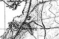
The Rimburger mills have their sites on the right and left side of the worm at the Bruchhausener Street, near Castle Rimburg in the city Übach-Palenberg. The height of the mill buildings is 87 m above sea level . The Wurm is the border river between Germany and the Netherlands . The Nivelsteiner Mühle was located above ; the Marienthaler Mühle once stood below .
Waters
The worm supplied numerous mills with water over a river length of 53 km. The source of the worm is located south of Aachen at 265 m above sea level, the confluence with the Rur is near the village of Kempen in the city of Heinsberg at 32 m above sea level. In the late 1960s and early 1970s, worm straightening was carried out. The curving, now and then meandering course of the river disappeared in favor of a simple route . The river length shortened and the flow speed increased. For many people the flood protection improved , for the mills it was the end. The water association Eifel-Rur (WVER) is responsible for the care and maintenance of the water body with a catchment area of 355.518 km 2 .
History of the grinding mill
The first known documentary mention of the Rimburg mill goes back to 1543. The mill stands directly in front of the farm yard of the impressive Rimburg Castle. The list of tenants has been passed down precisely from 1642. The first tenant Leonhard Nötlings had z. B. 50 Malter agreed to deliver rye as lease , plus 24 thalers , 6 pounds of sugar , a fat pig and 300 eggs . The tenant was also used for manual and tensioning services and had to grind free of charge for the castle economy. In return , the mill was designated as a compulsory mill and thus had a steady customer base . The Rimburg mill had two water wheels. The mill building from the early 19th century is now used for residential purposes.
In 1947, Dutch annexation plans were implemented as a result of World War II . After the Second World War, the Netherlands demanded compensation for the war damage. For this purpose, on April 23, 1949, in accordance with the final declaration of the London Germany Conference of December 23, 1948, various border areas were placed under Dutch contract administration. At Rimburg, the border should no longer represent the Wurm, but the railway line. Rimburg mill and castle and surrounding meadows became Dutch. In 1963 these areas were returned in the so-called Holland Treaty. The Wurm became Grenzbach again, but no longer in the old, meandering course, as the Wurm was straightened and expanded.
History of the oil mill
On the opposite, now Dutch side of the worm was an oil mill , which also belonged to Rimburg Castle. It was built in the second half of the 16th century. In 1880 it underwent a thorough renovation and a switch to turbine drive . It too has long been silent and is now a residential building .
Monument entry
Rimburger Mühle : Core dating probably 18th century; formerly part of Rimburg; two-storey in brick, white grouted. Today's components are essentially from the 19th century.
List of monuments Übach-Palenberg No. 10
gallery

Rimburg Castle opposite the mills

Part of the Rimburg grinding mill

The worm at the Rimburg mills

left the German mill, right the Dutch mill

Rimburg Castle with mills on the first recording from 1846
Rimburg Castle with mills on the new record from 1892

Rimburg Castle with mills on the Tranchot card 1805/1807

The Wurm as a border river near Rimburg

.jpg)


literature
- Hans Vogt: Lower Rhine water mill guide 2nd edition. Verein Niederrhein, Krefeld 1998, ISBN 3-00-002906-0 , pages 281–282.
→ See also the list of mills on the Wurm
Web links
Individual evidence
- ^ German basic map 1: 5000
- ↑ Topographical Information Management, Cologne District Government, Department GEObasis NRW ( Notes )
- ↑ Archived copy ( memento of the original from October 17, 2013 in the Internet Archive ) Info: The archive link was inserted automatically and has not yet been checked. Please check the original and archive link according to the instructions and then remove this notice.
- ↑ http://www.wver.de/
- ^ [1] Holland Treaty, see pages 54 and 62
At the worm :
Beeretz mill |
Bommers Mill |
Frelenberger Mill |
Horriger Mill |
Hünshovener oil mill |
Grinder and Oil Mill Trips |
Marienthaler Mill |
Müllendorfer mill |
Lohmühle |
Lohmühle |
Eichenthal Mill |
Mill Hommerschen |
Oil and paper mill Oberbruch |
Porselener Mill |
Randerather oil mill |
Rimburg mills |
Süggerather mill |
Interrupt mill |
Full mill interruption |
Zweibrügger Mühle
An der Junge Wurm:
Aldenhover Mühle |
Brünkers Mill |
Dahlmühle |
Horster mill |
Karker Mill |
Kemper Mill |
Lambertz Mill |
Liecker mill |
Powder mill ] |
Schafhausen grain mill |
Schafhausen oil mill |
Town mill |
Valley mill |
Wolfhager Mühle
Am Rodebach :
Brommler Mühle |
Dahlmühle |
Angel Mill |
Etzenrather mill |
Ingentaler Mill |
Isenbruch Mill |
Istrater mill |
Tüddern grain mill |
Millener mills |
Mohrenmühle |
Square mill |
Vollmühle Tüddern |
Wehrer Mühle
An der Schwalm :
Bischofsmühle |
Post mill |
Kornmühle Tüschenbroich |
Kringsmühle |
Lohmühle |
Neumühle |
Oil mill Tüschenbroich |
Rossmühle |
Wegberger Mühle
Am Mühlenbach :
Buschmühle |
Holtmühle |
Meismühle |
Molz mill |
Schrofmühle
Am Helpensteiner Bach:
Dalheimer Mühle |
Helpensteiner Mill |
Rödgener Mühle
Am Beeckbach :
Ophover Mühle
Am Kitschbach :
Kitscher Mühle
Am Knippertzbach :
Knippertzmühle
Am Uebach :
Übacher Mühle