
Etzenrather mill
| Etzenrather mill
|
||
|---|---|---|
 Etzenrather Mühle in Mindergangelt |
||
| Location and history | ||
|
||
| Coordinates | 50 ° 58 '49 " N , 5 ° 57' 59" E | |
| Location | Germany | |
| Waters | Rodebach | |
| Built | Mentioned around 1492 in a border description | |
| Shut down | 1965 End of the mill activity | |
| technology | ||
| use | Flour mill | |
| Grinder | 2 grinding courses | |
| drive | Watermill | |
| water wheel | undershot | |
| Website | Website of the Etzenrather Mill | |

The Etzenrather mill is a former on Rodebach preferred water mill with an undershot waterwheel in Gangelt , a rural community in North Rhine-Westphalia Heinsberg district .
geography
The Etzenrather Mühle is located on the right side of the stream on Rodebach in Mindergangelt, a district of the Gangelt community. The area on which the courtyard and mill building stands is approx. 58 m above sea level . The neighboring mills are the Brommler Mühle upstream and the Roermolen downstream in Jabeek in the Netherlands .
Waters
Up until the last century, the Rodebach supplied fourteen mills with water. The stream begins at a retention basin near Siepenbusch in the town of Übach-Palenberg at an altitude of 105 m above sea level. The Rodebach has a length of 28.9 km to its confluence with the Geleenbeek near Oud-Roosteren in the Netherlands . The mouth height is 29 m above sea level. The care and maintenance of the Rodebach and its tributaries is subject to the respective neighboring cities and communities. → See also Rodebach
history
The Etzenrather Mühle takes its name from the nearby town of Etzenrade, which is now a Dutch village. The first mention comes from a border description on the occasion of a strange accident in 1492. A clergyman fell from a jetty and drowned while crossing the Rodebach. It is reported from 1591 that the mill was set on fire . In 1913 a turbine and a little later an electric motor were installed in the flour mill . Sinking water levels and increasing siltation made the mill operation more difficult. The river straightening in 1965 then brought the end of the mill activities. Today, the converted mill as a tourist cafe serves on the edge of the deer enclosure Gangelt and nature parks Selfkant .
gallery

Etzenrather mill on Rodebach

Etzenrather Mühle in Mindergangelt

Millstone in the restaurant

Residential and farm buildings
Boundary stone at the Etzenrath mill

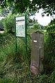
Information board at the mill

Tranchot card 1804/05


literature
- Hans Vogt: Lower Rhine water mill guide. 2nd Edition. Verein Niederrhein, Krefeld 1998, ISBN 3-00-002906-0 , pp. 244 + 247.
- Wilhelm Pieper: The last mill wheel on the Rodebach. In: Heimatkalender 1995. Kreis Heinsberg, pp. 158–164.
- State survey office of North Rhine-Westphalia topographic map 1:50 000 L 5102 Geilenkirchen and L 5000 Selfkant, ISBN 3-89439-417-X .
Web links
At the worm :
Beeretz mill |
Bommers Mill |
Frelenberger Mill |
Horriger Mill |
Hünshovener oil mill |
Grinder and Oil Mill Trips |
Marienthaler Mill |
Müllendorfer mill |
Lohmühle |
Lohmühle |
Eichenthal Mill |
Mill Hommerschen |
Oil and paper mill Oberbruch |
Porselener Mill |
Randerather oil mill |
Rimburg mills |
Süggerather mill |
Interrupt mill |
Full mill interruption |
Zweibrügger Mühle
An der Junge Wurm:
Aldenhover Mühle |
Brünkers Mill |
Dahlmühle |
Horster mill |
Karker Mill |
Kemper Mill |
Lambertz Mill |
Liecker mill |
Powder mill ] |
Schafhausen grain mill |
Schafhausen oil mill |
Town mill |
Valley mill |
Wolfhager Mühle
Am Rodebach :
Brommler Mühle |
Dahlmühle |
Angel Mill |
Etzenrather mill |
Ingentaler Mill |
Isenbruch Mill |
Istrater mill |
Tüddern grain mill |
Millener mills |
Mohrenmühle |
Square mill |
Vollmühle Tüddern |
Wehrer Mühle
An der Schwalm :
Bischofsmühle |
Post mill |
Kornmühle Tüschenbroich |
Kringsmühle |
Lohmühle |
Neumühle |
Oil mill Tüschenbroich |
Rossmühle |
Wegberger Mühle
Am Mühlenbach :
Buschmühle |
Holtmühle |
Meismühle |
Molz mill |
Schrofmühle
Am Helpensteiner Bach:
Dalheimer Mühle |
Helpensteiner Mill |
Rödgener Mühle
Am Beeckbach :
Ophover Mühle
Am Kitschbach :
Kitscher Mühle
Am Knippertzbach :
Knippertzmühle
Am Uebach :
Übacher Mühle