Meismühle
| Meismühle
|
||
|---|---|---|
|
Meismühle in Wegberg-Balkhoven |
||
| Location and history | ||
|
|
||
| Coordinates | 51 ° 9 '23 " N , 6 ° 17' 27" E | |
| Location |
|
|
| Waters | Mühlenbach | |
| Built | before 1557 in the Vogtgedingen | |
| Shut down | 1601 by breaking off | |
| technology | ||
| use | Grain mill | |
| drive | Watermill | |
| water wheel | undershot | |
The Meismühle was a water mill with an undershot water wheel .
geography
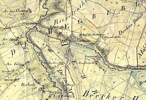
The Meismühle was located between the Buschmühle and the Schrofmühle near the former settlement of Balkhoven in the middle town of Wegberg in the Heinsberg district . There was a pond in front of the mill , the water level is now 64 m above sea level.
Waters
The Meismühle was on the Mühlenbach, which begins in Herrath and flows into the Schwalm at the Molzmühle . The Mühlenbach has a length of 13,475 m. The start of the stream is 77 m above sea level, the mouth at 61 m above sea level. Between Kipshoven and Holtmühle, the Mühlenbach forms the city boundary between the Heinsberg district and the city of Mönchengladbach . The upstream pond was fed by the Mühlenbach. Care and maintenance is the responsibility of the Schwalm Association , which is based in Brüggen .
history
The Meismühle got its name from a certain Bartholomäus, who was called "Bartholomais or Mevis" in the Old Lower Rhine region. But there is also a report of a "Peter in the Balkmühlen". "Balkmühle" referred to the neighboring settlement "Balkhoven". It was also the subject of complaints from neighbors with the Vogtgedingen in 1557/66. Since it was also located in a narrow space of only 750 m in the middle between the two other attacked mills, its owner had to defend himself in two ways and on two sides.
That was - indirectly at least - related to the traffic jam. The mill was not only a nuisance to the people living near the stream, but also to the bush miller, who was concerned about the unhindered flow of the underwater. He had offered the foreman two acres of land in exchange for the promise to clear the jam and the mill. He had accepted the offer, but then died. Because the consent was only given orally, the Beeck aldermen had to decide on the process. In the winter of 1600/01, for example, witnesses were heard. They confirmed the deal. After questions of inheritance and guardianship had been clarified, the court had determined the validity of the agreement.
Because everything went relatively smoothly and two acres of land were not exactly an exhilarating value, the owners will have been happy to get rid of the unloved and probably unprofitable mill. The corn mill was broken off. Except for files, she left no traces.
literature
- Lower Rhine water mills - guide by Hans Vogt
- The Schwalm - Valley of the Mills by Horst Jungblut - Helmut Elstner
- Home book of the city of Wegberg - Compiled by Heinz Cohnen
- Wegberg cultural guide
Web links
- Stadtmarketing Wegberg (Ed.): Discover Wegberg in the valley of the 24 mills . 2013 ( wegbergermuehlen-leudalmolens.eu [PDF; 2.0 MB ; accessed on February 13, 2016]).
- Mill tour

