
Kitschbach
|
Kitschbach Schaafbach |
||
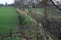
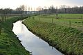
 Kitschbach near Karken |
||
| Data | ||
| Water code | DE : 28296 | |
| location |
Germany
|
|
| River system | Rhine | |
| Drain over | Rur → Maas → Hollands Diep → North Sea | |
| River basin district | Meuse | |
| source | Beginning of the stream in forest dampness - Löcken 51 ° 3 ′ 51 ″ N , 6 ° 2 ′ 9 ″ E |
|
| Source height | 54 m above sea level NN | |
| muzzle | at Vlodrop NL in the Rur coordinates: 51 ° 7 '27 " N , 6 ° 4' 48" E 51 ° 7 '27 " N , 6 ° 4' 48" E |
|
| Mouth height | approx. 29 m above sea level NN | |
| Height difference | approx. 25 m | |
| Bottom slope | approx. 2.7 ‰ | |
| length | 9.1 km | |
| Catchment area | 54.439 km² | |
| Drain at the mouth |
MNQ MQ |
65.64 l / s 304.57 l / s |
The Kitschbach is a nine kilometer long, left-hand stream in the Rur-Maas river system in the North Rhine-Westphalian district of Heinsberg , in the administrative district of Cologne .
geography
course
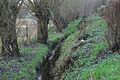
The Kitschbach with a length of 10.439 kilometers begins in the village of Waldfeucht-Löcken at an altitude of 54 m above sea level. NN . It then flows in a north-westerly direction along the places Schöndorf and Obspringen towards Haaren. At Obspringer Straße, the Kitschbach takes on the Waldfeuchter Bach and flows in a north-easterly direction. At the Driesch in Haaren, the treated wastewater from the sewage treatment plant is collected before the further path leads past the former Kitscher Mühle . After the flood ditch has been recorded, the stream flows through the northern part of Karken towards Wolfhager Mühle . In this area, the Kitschbach is also commonly called Schaafbach . At the Wolfhager Motte , the Mühlenbach flows into the water from the right. After passing the Wolfhager Mühle, the Kitschbach (Schaafbach) reaches the German - Dutch border and flows about 600 meters as a border river , before flowing the last 500 m over Dutch territory from the left at a height of 29 m above sea level. NN flows into the Rur .
Tributaries
- Waldfeuchter Fliess (GKZ 282962) ( left ), 3.0 km
- Flutgraben (GKZ 282964) ( right ), 4.9 km
- Vlootbeek ( left junction to the Meuse ). 18.4 km
- Mühlenbach (GKZ 282966) ( Mühlengraben ) ( right ), 2.8 km
character
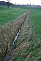
The Kitschbach is a stream that drains the areas around forest moisture and hairs northwest of Heinsberg . This makes the Kitschbach an important element of surface drainage during floods and snowmelt .
gallery
Beginning of the stream in Waldfeucht-Löcken
Kitschbach below Schöndorf
Pollard willows at Kitscbach

Kitschbach on Obspringer Strasse
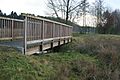
Wooden bridge over the Kitschbach
The Kitschbach between Kitscher Mühle and Karken

Residential and farm buildings of the former kitsch mill


Mill on the Kitschbach
Kitscher Mühle in Waldfeucht-Haaren on the Kitscherweg.
literature
- Hans Vogt: Lower Rhine water mill guide 2nd edition. Verein Niederrhein, Krefeld 1998, ISBN 3-00-002906-0 , pages 319.
- Hubert Berens: The Kitschermühle History and Documentation 1992
Web links
Individual evidence
- ↑ a b German basic map 1: 5000
- ↑ Topographical Information Management, Cologne District Government, Department GEObasis NRW ( Notes )
- ↑ Area directory for the water stationing map of the state of North Rhine-Westphalia ( Memento of the original from October 17, 2013 in the Internet Archive ) Info: The archive link was inserted automatically and has not yet been checked. Please check the original and archive link according to the instructions and then remove this notice. (PDF file; 543 kB)
- ↑ ELWAS card