Cellar (Kürten)
|
basement, cellar
Kurten municipality
Coordinates: 51 ° 0 '11 " N , 7 ° 12' 58" E
|
||
|---|---|---|
| Postal code : | 51515 | |
| Area code : | 02207 | |
|
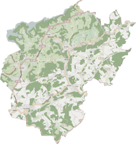
Location of Keller in Kürten |
||
|
Cellar on Dürschtalstrasse
|
||
Keller is a district in the municipality of Kürten in the Rheinisch-Bergisches Kreis .
history
Keller is first mentioned in writing in a lease from February 22, 1554, with which the Komtur from Herrenstrunden leases the Igeler Hof to the "tenant Thonis", the son of Jan zum Keller (near Dürscheid ) and his wife Steyngen (Christina) .
The place is shown in the topographical survey of the Rhineland from 1824.
Under the French administration between 1806 and 1813, the Porz office was dissolved and the Dürscheid Honschaft , to which Keller also belonged, was politically assigned to Mairie Bensberg in the Mülheim am Rhein arrondissement . In 1816 the Prussians converted the Mairie to the mayor's office in Bensberg in the Mülheim am Rhein district . Keller had 27 inhabitants in 1830.
In the list of the Kingdom of Prussia for the 1885 census, the cellar was listed as a place to live in the rural community of Bensberg in the Mülheim am Rhein district. At that time, there were 11 houses with 67 inhabitants.
Due to the Cologne Act , the municipality of Kürten was merged with the previously independent municipalities of Bechen and Olpe and parts of the city of Bensberg to form the municipality of Kürten with effect from January 1, 1975 . Keller also became part of the municipality of Kürten.
location
The basement is on Dürschtalstrasse, which leads to Klefhaus . It borders on the Dürschbachtal nature reserve . In the meantime, a small village has emerged here, the buildings of which are mainly located away from Dürschtalstrasse on a mountain slope sloping towards the east. The manor has meanwhile transformed the farm into a riding stable.
Mining
In the vicinity of Keller was the Gustav-Adolph mine field , which was consolidated with the Luther mine . In the middle between the places Keller and Kalkofen you will find the pinge of an experimental shaft , which is surrounded by a circular heap . Four trenches in the vicinity also come from mining .
Individual evidence
- ^ Anton Jux The Bergisch Botenamt Gladbach - The history of Bergisch Gladbach up to the Prussian period , published by the Kulturamt der Stadt Bergisch Gladbach 1964, p. 381
- ^ Friedrich von Restorff: Topographical-statistical description of the Royal Prussian Rhine Provinces , Berlin and Stettin, 1830
- ↑ Königliches Statistisches Bureau (Prussia) (Ed.): Community encyclopedia for the Rhineland Province, based on the materials of the census of December 1, 1885 and other official sources, (Community encyclopedia for the Kingdom of Prussia, Volume XII), Berlin 1888.
Web pages
- Street names of the municipality of Kürten - origin and meaning. Retrieved April 7, 2017 .

