Christmas tree (Kürten)
|
Christmas tree
Kurten municipality
Coordinates: 51 ° 3 ′ 19 ″ N , 7 ° 16 ′ 38 ″ E
|
||
|---|---|---|
| Height : | 178 m | |
| Postal code : | 51515 | |
| Area code : | 02268 | |
|
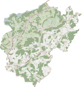
Location of Tannenbaum in Kürten |
||
|
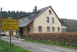
Home of the "Kürter Buurs 97/98", photo from 2017
|
||
Tannenbaum is a district in the municipality of Kürten in the Rheinisch-Bergisches Kreis .
description
The place Tannenbaum is on the state road 286 east of Kürten. According to the interpretation of the local history association, it got its name from a pine tree that once stood here. There are several houses to the left and right of the country road and in a side street.
history
From the Prussian new admission in 1892, the district is regularly recorded as a Christmas tree on measuring table sheets . At that time Tannenbaum belonged to the municipality of Olpe.
The municipal and Gutbezirksstatistik the Rhine Province leads Tannenbaum 1871 with a house and six residents. In the parish dictionary for the Rhineland province of 1888, two houses with ten residents are given. In 1895 the place had a house and three residents. In 1905 the place had two houses and eight residents and belonged denominationally to the Catholic parish of Olpe.
In 1927 the Olpe mayor's office was transferred to the Olpe office. In the Weimar Republic in 1929 the offices of Kürten were merged with the municipalities of Kürten and Bechen and Olpe with the municipalities of Olpe and Wipperfeld to form the office of Kürten. The Wipperfürth district became part of the Rheinisch-Bergisch district on October 1, 1932, with its seat in Bergisch Gladbach .
In 1975 the current municipality of Kürten was established on the basis of the Cologne Act , to which, in addition to the offices of Kürten, Bechen and Olpe, a sub-area of the city of Bensberg with Dürscheid and the surrounding areas was added.
Individual evidence
- ↑ Street names of the municipality of Kürten - origin and meaning, place and hamlet names No. 45. Retrieved on April 19, 2017 .
- ↑ Royal Statistical Bureau Prussia (ed.): The communities and manor districts of the Prussian state and their population . The Rhine Province, No. XI . Berlin 1874.
- ↑ Königliches Statistisches Bureau (Prussia) (Ed.): Community encyclopedia for the Rhineland Province, based on the materials of the census of December 1, 1885 and other official sources, (Community encyclopedia for the Kingdom of Prussia, Volume XII), Berlin 1888.
- ↑ Königliches Statistisches Bureau (Prussia) (Ed.): Community encyclopedia for the Rhineland Province, based on the materials of the census of December 1, 1895 and other official sources, (Community encyclopedia for the Kingdom of Prussia, Volume XII), Berlin 1897.
- ↑ Royal Statistical Bureau (Prussia) (Ed.): Community encyclopedia for the Rhineland Province, based on the materials of the census of December 1, 1905 and other official sources, (Community encyclopedia for the Kingdom of Prussia, Volume XII), Berlin 1909
- ^ History of the municipality of Kürten
- ^ GV. NRW. 1974 p. 1072

