Heidergansfeld
|
Heidergansfeld
Kurten municipality
Coordinates: 51 ° 2 ′ 37 ″ N , 7 ° 12 ′ 45 ″ E
|
||
|---|---|---|
| Height : | 252 m | |
| Postal code : | 51515 | |
| Area code : | 02207 | |
|
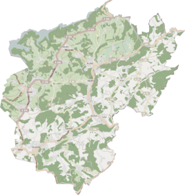
Location of Heidergansfeld in Kürten |
||
Heidergansfeld , popularly also called Heiderjansfeld, is a residential area in the municipality of Kürten in the Rheinisch-Bergisches Kreis .
Location and description
The place is north of Bechen and Neuensaal on the federal highway 506 . Together with these, it forms a closed settlement area, so that it no longer appears as an independent place. The area is located in the middle of the Bechener plateau at an altitude of 252 m above sea level. NHN . The lower Weyerbach of the Dürschbach rises nearby .
etymology
The appellative in the place name goes back to a field as if easily recognizable, the determiner goes back to the nickname Heiderjohann. The original form of the name is probably Heiderjansfeld, i.e. Johann Heider's field . This is how Heiderjansfelder Straße is named. The place is recorded on the topographical survey of the Rhineland from 1824 as Heidrigansfeld and on the Prussian first survey from 1840 as Heidergransfeld . On the Prussian new recording from 1892 and on all the more recent measuring table sheets it is consistently recorded as Heidergansfeld .
history
The place was on the Heerweg Cologne – Wipperfürth – Soest , an important medieval old highway from Cologne via Wipperfürth to Soest . In 1822, 65 people lived in the place categorized as Hof and called Heidergansfeld . In 1830 the place had 74 inhabitants. It belonged to the village of Bechen, which finally became a municipality in 1845. The place categorized as a hamlet according to the overview of the government district of Cologne in 1845 had a residential building at that time. At that time, nine residents lived in the place now designated Heiderjansfeld , all of them of Catholic faith. The local and Gutbezirksstatistik the Rhine Province leads Heider goose field 1871 with 34 houses and 102 residents. In the municipality lexicon for the province of Rhineland from 1888, 24 houses with 102 inhabitants are given. In 1895 the place had 22 houses and 87 inhabitants. In 1905 the place had 24 houses and 101 inhabitants and belonged denominationally to the Catholic parish of Bechen.
In 1927 the mayor's office in Bechen was transferred to the office of Bechen. In the Weimar Republic in 1929 the offices of Kürten were merged with the municipalities of Kürten and Bechen and Olpe with the municipalities of Olpe and Wipperfeld to form the office of Kürten. The Wipperfürth district became part of the Rheinisch-Bergisch district on October 1, 1932, with its seat in Bergisch Gladbach .
In 1975 the current municipality of Kürten was established on the basis of the Cologne Act , to which, in addition to the offices of Kürten, Bechen and Olpe, a sub-area of the city of Bensberg with Dürscheid and the surrounding areas was added.
Individual evidence
- ^ Heinrich Dittmaier : settlement names and settlement history of the Bergisches Land . In: Journal of the Bergisches Geschichtsverein . tape 74 , parallel edition as a publication by the Institute for Historical Regional Studies of the Rhineland at the University of Bonn. Schmidt, Neustadt ad Aisch 1956.
- ↑ Herbert Nicke : Forgotten ways: the historical network of long-distance routes between the Rhine, Weser, Hellweg and Westerwald, its protective systems and junctions . In: Land and history between Berg, Wildenburg and South Westphalia . tape 9 . Galunder, Wiehl 2001, ISBN 3-931251-80-2 , pp. 85 f .
- ↑ Alexander A. Mützell: New topographical-statistical-geographical dictionary of the Prussian state . tape 3 . Karl August Künnel, Halle 1822.
- ↑ Friedrich von Restorff : Topographical-statistical description of the Royal Prussian Rhine Province , Nicolai, Berlin and Stettin 1830
- ↑ Overview of the components and list of all the localities and individually named properties of the government district of Cologne: by districts, mayor's offices and parishes, with information on the number of people and the residential buildings, as well as the Confessions, Jurisdictions, Military and former state conditions. / ed. from the Royal Government of Cologne [Cologne], [1845]
- ↑ Royal Statistical Bureau Prussia (ed.): The communities and manor districts of the Prussian state and their population . The Rhine Province, No. XI . Berlin 1874.
- ↑ Königliches Statistisches Bureau (Prussia) (Ed.): Community encyclopedia for the Rhineland Province, based on the materials of the census of December 1, 1885 and other official sources, (Community encyclopedia for the Kingdom of Prussia, Volume XII), Berlin 1888.
- ↑ Königliches Statistisches Bureau (Prussia) (Ed.): Community encyclopedia for the Rhineland Province, based on the materials of the census of December 1, 1895 and other official sources, (Community encyclopedia for the Kingdom of Prussia, Volume XII), Berlin 1897.
- ↑ Royal Statistical Bureau (Prussia) (Ed.): Community encyclopedia for the Rhineland Province, based on the materials of the census of December 1, 1905 and other official sources, (Community encyclopedia for the Kingdom of Prussia, Volume XII), Berlin 1909
- ^ History of the municipality of Kürten
- ^ GV. NRW. 1974 p. 1072
