Bölinghoven
|
Bölinghoven
Kurten municipality
Coordinates: 51 ° 0 ′ 47 ″ N , 7 ° 12 ′ 10 ″ E
|
||
|---|---|---|
| Postal code : | 51515 | |
| Area code : | 02207 | |
|
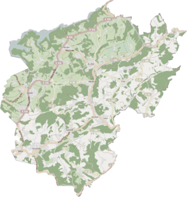
Location of Bölinghoven in Kürten |
||
|
Farm in Bölinghoven
|
||
Bölinghoven is a residential area in the municipality of Kürten in the Rheinisch-Bergisches Kreis .
history
Bölinghoven was first mentioned in a document in 1054 as Budelinchove . The place name is a representative of the -inghofen name group, which denotes the establishment of a farm by a person named in the name prefix. The personal name at Budelinchove is likely to have been a Bodilo , so the place name means court of the Bodilo clan .
According to a non-scientific and probably incorrect interpretation of the local history association, however, the name Bölinghoven Hof means on the top, located on the hill, "Böhl, also Bühl means hill , hill . In dialect it is called op Böhlekoven.
The Topographia Ducatus Montani by Erich Philipp Ploennies , Blatt Amt Porz , shows that the residential area had two farmsteads as early as 1715, which are labeled as Boleckhofen . From the chart of the Duchy of Berg from 1789 by Carl Friedrich von Wiebeking it emerges that the place under the name Bolenhoff was at that time part of Honschaft Dürscheid in the upper court of Bensberg of the Bergisch office of Porz .
The place is recorded on the topographical survey of the Rhineland from 1824 as Bölenkowen , the Prussian first survey from 1845 as Büdinghoven . From the Prussian new admission of 1892, the place is regularly recorded as Bölinghoven on measuring table sheets .
Under the French administration between 1806 and 1813, the Porz office was dissolved and the parish Dürscheid , to which Bölinghoven also belonged, was politically assigned to the Mairie Bensberg in the Mülheim am Rhein arrondissement . In 1816 the Prussians converted the Mairie to the mayor's office in Bensberg in the Mülheim am Rhein district .
In 1822, twelve people lived in the village, which was categorized as a farm and is listed under the name Bülekoven . For the year 1830 16 inhabitants are given for Bülekoven . The town, which was categorized as a farm property in 1845 according to the overview of the government district of Cologne , had two residential buildings with 14 inhabitants, all of them Catholic denominations. The municipal and Gutbezirksstatistik the Rhine Province leads Biesfeld 1871 with two houses and eleven residents.
In the list of the Kingdom of Prussia for the 1885 census, Bölinghoven was recorded as the residential area of the rural community of Bensberg in the Mülheim am Rhein district. At that time 2 houses with 5 inhabitants were counted. In 1895 the place has three houses with eleven inhabitants and belonged to the Catholic parish of Dürscheid, in 1905 two houses and nine inhabitants are given.
Due to the Cologne Act , the municipality of Kürten was merged with the previously independent municipalities of Bechen and Olpe and parts of the city of Bensberg to form the municipality of Kürten with effect from January 1, 1975 . Bölinghoven also became part of the municipality of Kürten.
Individual evidence
- ↑ a b Street names of the municipality of Kürten, place and hamlet names , published by the history association for the municipality of Kürten and the surrounding area
- ^ A b Heinrich Dittmaier : Settlement names and settlement history of the Bergisches Land . In: Journal of the Bergisches Geschichtsverein . tape 74 , parallel edition as a publication by the Institute for Historical Regional Studies of the Rhineland at the University of Bonn. Schmidt, Neustadt a. d. Aisch 1956.
- ^ Wilhelm Fabricius : Explanations for the Historical Atlas of the Rhine Province ; Second volume: The map of 1789. Division and development of the territories from 1600 to 1794 ; Bonn; 1898
- ↑ Alexander A. Mützell: New topographical-statistical-geographical dictionary of the Prussian state . tape 1 . Karl August Künnel, Halle 1821.
- ↑ Friedrich von Restorff : Topographical-statistical description of the Royal Prussian Rhine Province , Nicolai, Berlin and Stettin 1830
- ↑ Overview of the components and list of all the localities and individually named properties of the government district of Cologne: by districts, mayor's offices and parishes, with information on the number of people and the residential buildings, as well as the Confessions, Jurisdictions, Military and former state conditions. / ed. from the Royal Government of Cologne [Cologne], [1845]
- ↑ Royal Statistical Bureau Prussia (ed.): The communities and manor districts of the Prussian state and their population . The Rhine Province, No. XI . Berlin 1874.
- ↑ Königliches Statistisches Bureau (Prussia) (Ed.): Community encyclopedia for the Rhineland Province, based on the materials of the census of December 1, 1885 and other official sources, (Community encyclopedia for the Kingdom of Prussia, Volume XII), Berlin 1888.
- ↑ Königliches Statistisches Bureau (Prussia) (Ed.): Community encyclopedia for the Rhineland Province, based on the materials of the census of December 1, 1895 and other official sources, (Community encyclopedia for the Kingdom of Prussia, Volume XII), Berlin 1897.
- ↑ Royal Statistical Bureau (Prussia) (Ed.): Community encyclopedia for the Rhineland Province, based on the materials of the census of December 1, 1905 and other official sources, (Community encyclopedia for the Kingdom of Prussia, Volume XII), Berlin 1909

