Oberbörsch
|
Oberbörsch
Kurten municipality
Coordinates: 51 ° 0 ′ 18 ″ N , 7 ° 13 ′ 57 ″ E
|
||
|---|---|---|
| Postal code : | 51515 | |
| Area code : | 02207 | |
|
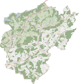
Location of Oberbörsch in Kürten |
||
Oberbörsch is a residential area in the municipality of Kürten in the Rheinisch-Bergisches Kreis .
Location and description
Oberbörsch is located off the regional roads on Calenberger Weg between the districts of Oberberg and Hähn on the southwestern edge of Kürten. Due to the increase in settlement, Oberberg forms a closed settlement area with the larger Oberbörsch.
The name Börsch means situated above the Börschbach. bos or bors means swampy or cloudy water. An alternative interpretation is Bösch , which means Busch. In dialect one speaks of op dr Bö'esch .
Börschbach
The name- giving Börschbach rises with two springs in the northern part of Oberbörsch.
history
From the chart of the Duchy of Berg in 1789 by Carl Friedrich von Wiebeking , it can be seen that Oberbörsch was part of the Engelsdorf community in the parish of Kürten at that time . Under the French administration between 1806 and 1813, the Steinbach office was dissolved and Oberbörsch was politically assigned to the Mairie Kürten in the canton of Wipperfürth . In 1816 the Prussians converted the Mairie to the mayor's office in Kürten in the Wipperfürth district . In 1845 Oberbörsch had four buildings and 30 residents of Catholic faith. Oberbörsch belonged to the parish of Kürten.
In the list of the Kingdom of Prussia for the 1885 census, Oberbörsch was listed as the residential area of the rural community of Kürten. At that time there were 12 houses with 56 inhabitants. In the first recording, the place is called Oberbusch . From the Prussian new admission from 1893-1896, the place is regularly recorded as Oberbörsch on measuring table sheets . In 1905 the place had ten houses with 53 inhabitants and belonged to the parish of Biesfeld .
Individual evidence
- ^ Street names of the municipality of Kürten, place and hamlet names , published by the history association for the municipality of Kürten and the surrounding area
- ↑ Overview of the components and list of all the localities and individually named properties of the government district of Cologne: by districts, mayor's offices and parishes, with information on the number of people and the residential buildings, as well as the Confessions, Jurisdictions, Military and former state conditions. / ed. from the Royal Government of Cologne [Cologne], [1845]
- ↑ Königliches Statistisches Bureau (Prussia) (Ed.): Community encyclopedia for the Rhineland Province, based on the materials of the census of December 1, 1885 and other official sources, (Community encyclopedia for the Kingdom of Prussia, Volume XII), Berlin 1888.
- ↑ Royal Statistical Bureau (Prussia) (Ed.): Community encyclopedia for the Rhineland Province, based on the materials of the census of December 1, 1905 and other official sources, (Community encyclopedia for the Kingdom of Prussia, Volume XII), Berlin 1909
