Winterberg (Kürten)
|
Winterberg
Kurten municipality
Coordinates: 51 ° 0 ′ 39 ″ N , 7 ° 13 ′ 31 ″ E
|
||
|---|---|---|
| Postal code : | 51515 | |
| Area code : | 02207 | |
|
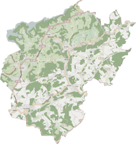
Location of Winterberg in Kürten |
||
|
The Winterberg 2017
|
||
Winterberg is a district in the municipality of Kürten in the Rheinisch-Bergisches Kreis .
Description and location
The road to Winterberg leads steeply south from Wipperfürther Strasse in Steeg up the mountain. The original place was on the same level. The main settlement did not begin until the middle of the 20th century and now begins directly on Wipperfürther Straße. Winterberg now forms a closed settlement area with Steeg, Dürscheid and Steintor .
Winterberg is located on a steep north slope, where the snow stays for a long time in winter. That's what gave it its name.
history
In the topographical survey of the Rhineland from 1824, the place is marked as winter mountains. At that time Winterberg belonged to the mayor's office of Kürten in the Wipperfürth district in the Prussian Rhine province . In 1830 the place had 24 inhabitants. In 1845 the place, categorized as a courtyard , had a residential building and 13 residents of Catholic faith.
In the list of the Kingdom of Prussia for the 1885 census, Winterberg was listed as the residential area of the rural community of Kürten. At that time, five houses with 26 residents were counted. In 1905 the place had three houses with 10 inhabitants and belonged to the parish of Dürscheid . From the Prussian first recording from 1836 to 1850, the place is regularly recorded on measuring table sheets as Winterberg .
The original development was only on a path halfway up the mountain. In the 1950s and 1960s the street down to Steeg was built with single-family houses. Later, the left side of the street visible in the picture was added with side streets. Nothing has been preserved from the original structure.
Individual evidence
- ↑ Street names of the municipality of Kürten - origin and meaning, No. 301. Retrieved on April 8, 2017 .
- ↑ Friedrich von Restorff : Topographical-statistical description of the Royal Prussian Rhine Province , Nicolai, Berlin and Stettin 1830
- ↑ Overview of the components and list of all the localities and individually named properties of the government district of Cologne: by districts, mayor's offices and parishes, with information on the number of people and the residential buildings, as well as the Confessions, Jurisdictions, Military and former state conditions. / ed. from the Royal Government of Cologne [Cologne], [1845]
- ↑ Königliches Statistisches Bureau (Prussia) (Ed.): Community encyclopedia for the Rhineland Province, based on the materials of the census of December 1, 1885 and other official sources, (Community encyclopedia for the Kingdom of Prussia, Volume XII), Berlin 1888.
- ↑ Royal Statistical Bureau (Prussia) (Ed.): Community encyclopedia for the Rhineland Province, based on the materials of the census of December 1, 1905 and other official sources, (Community encyclopedia for the Kingdom of Prussia, Volume XII), Berlin 1909

