Betul (city)
| Betul | ||
|---|---|---|
|
|
||
| State : |
|
|
| State : | Madhya Pradesh | |
| District : | Betul | |
| Location : | 21 ° 54 ' N , 77 ° 54' E | |
| Height : | 658 m | |
| Residents : | 103,330 (2011) | |
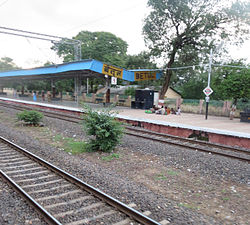
| Betul train station | ||
Betul is a city in the Indian state of Madhya Pradesh . The city is located in the south of the state and is near the geographic center of India, which is marked with a stone.
The city is the administrative center of the Betul district of the same name . Betul has the status of a Municipal Council . The city is divided into 34 wards (constituencies).
Demographics
The city's population is 103,330 according to the 2011 census. Betul has a gender ratio of 956 women per 1000 men and thus a common surplus of men for India. The literacy rate was 89.3% in 2011, well above the regional and national average. Almost 85% of the population are Hindus , approx. 12% are Muslim and approx. 3% belong to another or no religion. 10.8% of the population are children under 6 years of age.
Infrastructure
Betul was connected to the Delhi - Chennai route of the Indian rail network in the early 1950s. It now serves as a hub and provides the only access to Chindwara District on a broad gauge rail .
Individual evidence
- ↑ www.census2011.co.in
- ↑ Betul City Population Census 2011-2019 | Madhya Pradesh. Retrieved September 18, 2019 .

