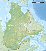
Charlevoix Biosphere Reserve
|
Charlevoix Biosphere Reserve
|
||
|
The Laurentides |
||
| location | Québec ( Canada ) | |
| surface | 4570 km² | |
| WDPA ID | 555593735 18922, 555593735 | |
| Geographical location | 47 ° 45 ′ N , 70 ° 45 ′ W | |
|
|
||
| administration | Commission canadienne pour L'UNESCO | |
The Charlevoix Biosphere Reserve is one of 16 biosphere reserves currently in Canada. It is located in the province of Québec and was recognized as such by UNESCO in 1988.
The biosphere reserve stretches along the coast from Petite-Rivière-Saint-François to Saint-Fidèle ; in addition to the river basins, it includes the Île aux Coudres , in the west from Le Massif to the Parc national des Grands-Jardins . In the north, the Réserve faunique des Laurentides is one of them , as is the Parc national des Hautes-Gorges-de-la-Rivière-Malbaie . The biosphere reserve covers a total of around 4570 km², and is inhabited by around 30,000 people. Around 650 km² enjoy more extensive protection as parks, plus the Center écologique de Port-au-Saumon . In the rest of the reserve, all economic activities that do not endanger the area may continue to be pursued.
The area is characterized by water-rich, post-glacial landscapes. The focus is on the catchment areas of the two rivers du Gouffre with an area of around 1000 km² and the Malbaie with 1850 km². Then there is the smaller basin of the Rivière Jean-Noël with around 132 km². In addition, the biosphere reserve has around 1200 lakes with an area of less than one hectare. Along the coast, the Île aux Coudres and the coast up to Cap-à-l'Aigle are of great importance, as this is where the belugas' nurseries are located. In addition, numerous bird species highlight the importance of the reserve. In addition, it is also geologically extraordinary, because an asteroid struck here about 350 million years ago, which was 2 km in diameter and weighed an estimated 15 billion tons (see Charlevoix (crater) ). The area is now the most earthquake-rich in eastern Canada, with most of the tremors having their epicenter under the St. Laurent River .
literature
- Serge Gauthier, Guy Godin: Raconte-moi ... la rivière Malbaie , Presses Université Laval, 2004.
Web links
Individual evidence
- ↑ UNESCO map of the Canadian biosphere reserves, as of 2011 .
- ↑ UNESCO Biosphere Reserves. Charlevoix. In: Ecological Sciences for Sustainable Development. UNESCO , accessed April 11, 2013 .

