Birzgale
| Birzgale ( German : Birsgallen) | ||
|---|---|---|
 |
|
|
| Basic data | ||
| State : |
|
|
| Landscape: | Semgallia ( Latvian : Zemgale ) | |
| Administrative district : | Ķegums district | |
| Coordinates : | 56 ° 38 ' N , 24 ° 45' E | |
| Residents : | 1,536 (Jan 1, 2017) | |
| Area : | 294 km² | |
| Population density : | 5 inhabitants per km² | |
| Height : | 45 m | |
| Website: | www.birzgale.lv | |
| Post Code: | 5033 | |
| ISO code: | ||
| School in Birzgale (2000) | ||
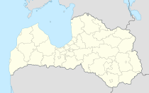
Birzgale (German: Birsgallen) is a municipality in the Ķegums district in Latvia . It is the largest municipality in the district and is located on the left bank of the Daugava . The municipality is located in the town of the same name.
The goods Halswigshof (Latvian: Alstiķu muiža ), Berghof (Latvian: Kalna muiža ) and Kanenneken (Latvian: Kannenieku muiža ) used to be located in the area of today's municipality . From Good Linden (Latvian: Linde ) is still preserved the historic park.
During the Russian Empire, today's municipal area was in the Courland Governorate .
Web links
Commons : Birzgale - collection of images, videos and audio files

