Bistinepass
| Bistinepass | |||
|---|---|---|---|
|
Bistinepass (2018) |
|||
| Compass direction | west | east | |
| Pass height | 2416 m above sea level M. | ||
| region | Valais , Switzerland | ||
| expansion | trail | ||
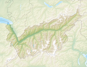
| Map (Valais) | |||
|
|
|||
| Coordinates | 641750 / 121092 | ||

The Bistine Pass , also known as the Bistine Pass , is a transition at 2,416 m above sea level. M. from the Simplon Pass to the Nanztal .
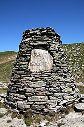
During the war , the third company of the Mountain Fusilier Battalion 35, which was part of the Mountain Infantry Regiment 17 and thus part of the Border Brigade 11 , erected a monument on the Bistine Pass. At that time, numerous road structures were built in the Nanztal and Simplon Passes and on their heights to observe and defend against attempts to bypass the Simplon Pass and its fortifications.
National hiking route 6 from Wanderland Schweiz leads over the pass . The so-called Alpine Pass Path from Chur to Saint-Gingolph leads on the stage from the Simplon Pass over the Bistine Pass through the Nanz Valley and on over the Gibidum Pass to Gspon . The hiking time for this section is approx. 7 ½ hours.
Crossings from the area of the Simplon Pass into the Nanztal, located parallel to the Bistine Pass, are the Nanzlicke , the Inner Nanzlicke and the Üsseri Nanzlicke to the north . To the south of it are the Magelicke and Sirwoltesattel . They are all higher than the Bistinepass.
Web links
Individual evidence
- ↑ Bistinepass on the map of the Federal Office of Topography : [1]
- ↑ Wanderland: Alpenpässeweg 6
- ↑ The Nanzlicken on the map of the Federal Office of Topography : [2]


