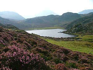
Blackbeck Tarn
| Blackbeck Tarn | ||
|---|---|---|

|
||
| Blackbeck Tarn | ||
| Geographical location | Lake District , Cumbria , England | |
| Drain | Black Beck | |
| Data | ||
| Coordinates | 54 ° 30 '14.9 " N , 3 ° 14' 3.3" W | |
|
|
||
| Altitude above sea level | 498 m ASL | |
| length | 183 m | |
| width | 80 m | |
| Maximum depth | 2.5 m | |
The Blackbeck Tarn is a lake in the Lake District , Cumbria , England . The Blackbeck Tarn lies between the Haystacks summit in the north and the Gray Knotts summit in the south.
The lake is located above the Buttermere lake and south of the Innominate Tarn and can be reached on the same route from the Buttermere.
The Blackbeck Tarn has several short, small tributaries and its outflow is the Black Beck , which flows into the Warnscale Beck .
