Blanca Lake
| Blanca Lake | ||
|---|---|---|

|
||
| Blanca Lake with the Columbia Glacier in the background, looking north. | ||
| Geographical location | Snohomish County , Washington (USA) | |
| Tributaries | Columbia Glacier | |
| Drain | Troublesome Creek → North Fork Skykomish River | |
| Data | ||
| Coordinates | 47 ° 56 '25 " N , 121 ° 20' 24" W | |
|
|
||
| Altitude above sea level | 1212 m | |
The Blanca Lake is a lake in the Henry M. Jackson Wilderness in the Cascade Range of the US state of Washington .
Blanca Lake is located in a basin surrounded by the peaks of Monte Cristo Peak , Kyes Peak, and Columbia Peak . The lake is fed by the Columbia Glacier in the northwest and drained by Troublesome Creek, a tributary of the North Fork Skykomish River . The cold, muddy glacier water gives the lake its spectacular turquoise-green color and makes it a prime example of a rock powder lake.
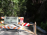
Blanca Lake can only be reached on foot via the Blanca Lake Trail. The trail begins at 579 meters above sea level, but the access road to the entry point is closed due to undercutting, so that about four miles (6.4 kilometers) detour extend the normally nine miles 14.4 kilometers long trail. The trail climbs quickly in serpentines and overcomes 823 meters in altitude over a length of 4.8 kilometers to finally arrive at the crest of the mountain range. From the ridge it continues through sub-alpine meadows until it reaches Virgin Lake at 1,402 meters. From Virgin Lake it goes over rocky, steep terrain over 0.8 kilometers and 183 meters in altitude down to Blanca Lake. Due to its high altitude and the large amount of snow typical of the Pacific Northwest, Blanca Lake is usually only easily accessible from July until the first snowfalls in October or November.
Despite the difficult climbing routes on the mountain path, its beauty makes the lake a popular destination for hikers.
To get to the entry point of the trail, use US Forest Road 65 / Beckler Road for 22 kilometers near Skykomish to the intersection with US Forest Road 63. Forest Road 63 is closed due to undercutting. A Northwest Forest Pass is required for parking; there is a US Forest Service Daily Fee of US $ 5 per vehicle.
Individual evidence
- ↑ a b Blanca Lake, WA . In: TopoQuest . United States Geological Survey . Retrieved November 5, 2008.
- ^ Blanca Lake in the Geographic Names Information System of the United States Geological Survey
- ^ Troublesome Creek . In: Geographic Names Information System . United States Geological Survey . September 10, 1979. Retrieved November 5, 2008.
- ↑ a b Blanca Lake Trail # 1052 . United States Forest Service . June 2002. Retrieved September 25, 2012.
- ↑ Blanca Lake . Washington Trails Association. October 22, 2008. Retrieved November 2, 2008.
Web links
- US Forest Service (English)


