
Blup blup
| Blup blup | ||
|---|---|---|
| Waters | Pacific Ocean | |
| Archipelago | Le Maire Islands | |
| Geographical location | 3 ° 30 '18 " S , 144 ° 36' 25" E | |
|
||
| length | 3.4 km | |
| width | 2.3 km | |
| surface | 3.5 km² | |
| Highest elevation | 402 m | |
| Residents | 513 (2000) 147 inhabitants / km² |
|
| main place | Gainai | |
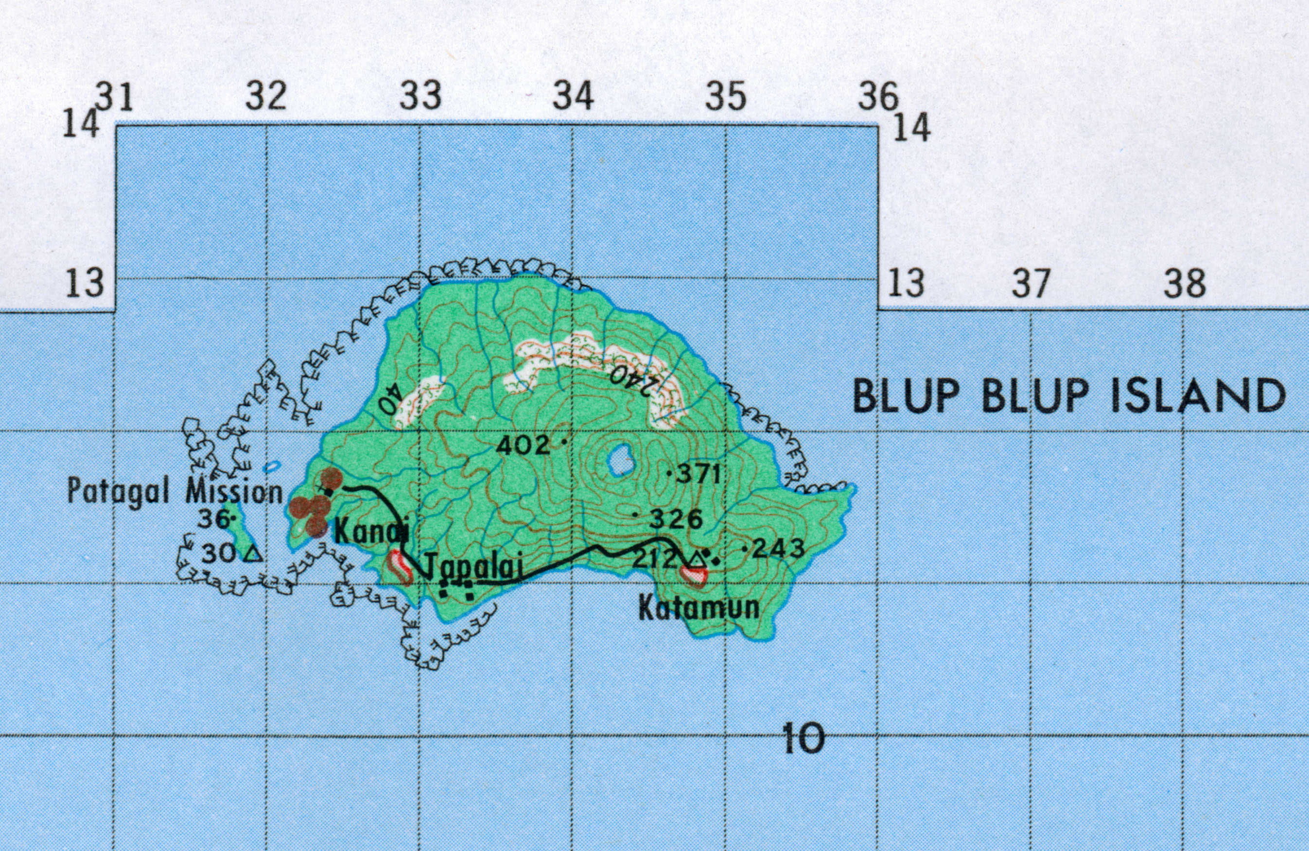
_Topography.png) |
||

Blup Blup , formerly also known as Garnot Island , is a small volcanic island in the South Pacific island state of Papua New Guinea ( East Sepik Province ).
Blup Blup belongs to the Le Maire Islands and is about 60 km east of the mainland ( Cape Girgir ). The highest point of the approximately 3.5 km² island is 402 m above sea level.
Around 800 meters west of the island are the small side islands Motmot Islet and Boluga Islet on the coral reef, which expands further to the west . The island has three villages: Gainai (212), Katamon (208) and Tabel (93 inhabitants).
Sources & web links
- Blup Blup in the Global Volcanism Program of the Smithsonian Institution (English)
- Topographic map of Blup Blup at the Australian National University
- Topographic map sheet 1: 100,000 from 1973 with Blup Blup
- Volcano (blup blup)
- Deutsches Kolonial-Lexikon (1920), Volume I, p. 221