Bomb Peak
| Bomb Peak | ||
|---|---|---|
|
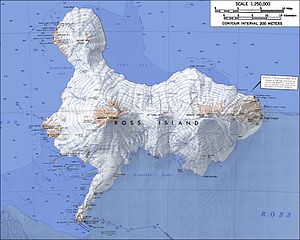
Topographic map of Ross Island (1: 250,000) with Bomb Peak on the edge of the Specially Protected Area at Cape Crozier (right) |
||
| height | 805 m | |
| location | Ross Island ( Ross Archipelago , Antarctica ) | |
| Coordinates | 77 ° 32 ′ 0 ″ S , 169 ° 15 ′ 0 ″ E | |
|
|
||
The Bomb Peak is a 805 m high mountain on the Antarctic Ross Island . It rises 3 km west of Cape Crozier .
Participants in the New Zealand Geological Survey Antarctic Expedition campaign, which ran from 1958 to 1959, mapped and named him. The pyroclastic rock formations at the top of the mountain give it its name.
Web links
- Bomb peak in the Geographic Names Information System of the United States Geological Survey (English)
- Bomb Peak on geographic.org (English)

