
Bonegilla
| Bonegilla | |||||||
|---|---|---|---|---|---|---|---|
 Bonegilla Hall |
|||||||
|
|||||||
|
|||||||
|
|||||||
|
|||||||
|
|||||||

Bonegilla is a small town with 693 inhabitants in the northeast of the Australian state of Victoria . It is about ten kilometers from Wodonga and over 300 kilometers from Melbourne .
history
The Bonegilla Post Office opened on August 20, 1878 and closed in 1951. The Bonegilla military office was in place from 1940 to 1947 and 1983 to 1998, from which it was relocated to nearby Bandiana .
The development of the place was dependent on the Cudgewa railway line , which opened in 1889 and closed in 1981. The railway line was used to transport building materials to the Snowy Mountains System and immigrants to Bonegilla Migrant Camp from Pier Station on Port Melbourne . The railway line has been dismantled and a section is now used as a bicycle and hiking trail, the High Country Rail Trail , which runs from Wodonga to the end of Lake Hume .
Bonegilla Migrant Camp
The Bonegilla Migrant Reception and Training Center was used to host immigrants upon their arrival after the end of World War II. The Bonegilla Migrant Camp , operated from 1947 to November 1971, was the largest and longest-running camp for immigrants in Australia, and about 1.5 million immigrants stayed there at times.
photos
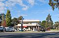
Bonegilla General Store

Entrance to the Latchford Barracks at Bonegilla

Bonegilla Migrant Camp, Block 4 (1954)

Sculpture in the grounds of the Bonegilla Migrant Camp


Web links
Individual evidence
- ↑ a b Australian Bureau of Statistics : Bonegilla ( English ) In: 2016 Census QuickStats . June 27, 2017. Retrieved April 15, 2020.
- ↑ premierpostal.com : Post Office List , accessed October 17, 2011