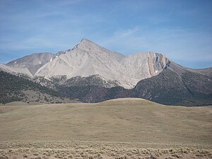
Borah Peak
| Borah Peak | ||
|---|---|---|
|
Borah Peak |
||
| height | 3857 m | |
| location | Custer County , Idaho , United States | |
| Mountains | Lost River Range | |
| Coordinates | 44 ° 8 '14 " N , 113 ° 46' 51" W | |
|
|
||
| First ascent | 1912 by TM Bannon | |
| Normal way | Southwest flank | |
The Borah Peak (also Mount Borah ) is the highest mountain in the US state of Idaho . The mountain is named after William Borah (1865–1940), a US Senator for Idaho.
The normal route on the southwest flank is by and large a strenuous hike until you reach the ridge before the main climb. This point is also known as Chickenout Ridge , as many hikers stop attempting to climb the mountain here as soon as they see the dangers in the final climb. There is a snow field with steep slopes on both sides to cross. An ice ax is recommended for this section.
The north side of Borah Peak is one of Idaho's few year-round snow-covered routes and makes for a much more challenging route than the normal route.
Three climbers have died trying to climb Borah Peak. Two climbers who climbed the northwest flank in 1977 were killed in an avalanche . Another mountaineer lost his life while descending in 1987.

See also
Web links
- Climbing Guide to Borah Peak (English)
- Information about the Borah Peak (English)

