Borgstorf
Borgstorf (Nieddt. Bösdorp) is the name of a village in the municipality of Schwanheide that died in the High Middle Ages . The village was located on a headland of the Büchener Sanders , which was pushed into the dolphin lowland , about 2 km north of Zweedorf on the way to Büchen-Dorf . The Feldmark bordered in the north on Bröthen , in the east on the Schwanenheide, in the south on Zweedorf and in the west on the Delvenauniederung. The German name of the village and the location between Zweedorf and Büchen-Dorf indicate a planned system as part of the medieval country development between 1158 and 1230. However, the village perished again before 1335, because as Eckart Marsow and his brothers in a document renounced their possessions in Borgstorf that same year, they no longer spoke of a village, but only of deme ghude tu Borghestorpe , that is, of the field mark . This field mark passed into sovereign property in 1459, when Otto von Schack sold his lands on the Ghude to Borchstorpe for 180 marks to Duke Heinrich IV of Mecklenburg . Only 5 years later he pledged the land to the Zarrentin monastery , which already owned the village of Zweedorf. The Borgstorfer areas were cultivated by the Zweedorfer farmers, who paid an annual rent of 14 marks for this in 1460.
Individual courtyards in the Zweedorfer district of Neu-Zweedorf , which was newly settled as part of the separation around 1850 on the way to Büchen-Dorf, were located on the former Borgstorf village.
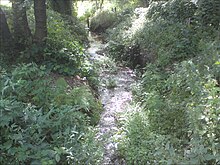
Until the 1960s, today's Riedebeck , an eastern tributary of the Delvenau, bore the name Borgstorfer Bach, which was mentioned in the state border files as early as 1586. The land map still showed the field name Bösdorp at the old village location in 1979 . With the reassignment of the street names in the municipality of Schwanheide on January 1, 2011, the name Bösdorfer Weg was canceled for the old connecting road from Zweedorf to Büchen-Dorf and the last remaining evidence of the submerged village was deleted.
Individual evidence
- ^ Dieter Greve: Field name atlas for the southern west Mecklenburg. , Volume I, Schwerin 2011 ISBN 978-3-940207-25-8 , p. 154
- ^ Franz Schildt: The submerged villages of Mecklenburg-Schwerins. in: Association for Mecklenburg History and Archeology: Yearbooks of the Association for Mecklenburg History and Archeology. - Vol. 56 (1891), pp. 149–222, here p. 153 online version ( Memento of February 8, 2011 in the Internet Archive )
- ^ Quoted from Franz Schildt: The submerged villages of Mecklenburg-Schwerins. in: Association for Mecklenburg History and Archeology: Yearbooks of the Association for Mecklenburg History and Archeology. - Vol. 56 (1891), pp. 149–222, here p. 152
- ^ Quoted from Franz Schildt: The submerged villages of Mecklenburg-Schwerins. in: Association for Mecklenburg History and Archeology: Yearbooks of the Association for Mecklenburg History and Archeology. - Vol. 56 (1891), pp. 149-222, here p. 153
- ^ Wolfgang Prange: Settlement history of the state of Lauenburg in the Middle Ages. Neumünster 1960, page 23
- ↑ W. Hertelsche map of 1860 with updates in 1979
Coordinates: 53 ° 26 ′ 46 ″ N , 10 ° 38 ′ 17 ″ E
