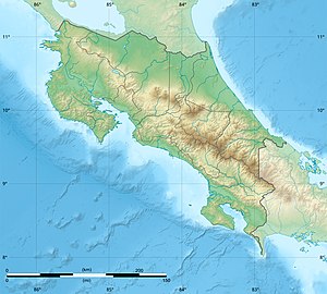
Boruca (dam)
| Boruca (dam) | |||||
|---|---|---|---|---|---|
|
|||||
|
|
|||||
| Coordinates | 9 ° 0 ′ 0 ″ N , 83 ° 18 ′ 0 ″ W | ||||
| Data on the structure | |||||
| Construction time: | under construction | ||||
| Height above foundation level : | between 167 and 267 m | ||||
| Building volume: | 43 million m³ | ||||
| Power plant output: | 1500 MW | ||||
| Data on the reservoir | |||||
| Water surface | 250 km² | ||||
| Storage space | 14,960 million m³ | ||||
Boruca was a dam project ( Spanish Proyecto Hidroelectrico Boruca , English Boruca Hydroelectric Project ) on the Río Térraba (Rio Grande de Terraba) in the south of Costa Rica near Palmar Norte. The project was in the planning stage, but has since been abandoned and replaced by the El Diquís hydropower project . The construction was delayed because of the bad economic situation and because of the protests against the project.
Technical specifications
Serious technical information about this dam project is hard to find. For example, the height of the barrier structure is given completely differently with 167 m, 180 m, 260 m or 267 m. The reservoir would have been 250 square kilometers, the storage capacity around 15 billion cubic meters.
Use
The Costa Rican government has had studies carried out for the hydropower project since the 1970s . The electricity generated could supply all of Costa Rica; part of it is to be directed to Mexico and the USA, and an aluminum plant is to be supplied. Only 15% is intended for local electricity consumption. The operator is the state electricity company Instituto Costaricense de Electricidad (ICE). There is talk of construction costs of 1.7 to 3 billion dollars.
disadvantage
Six tribal areas of indigenous people in southern Costa Rica would be affected by the reservoir, three of them directly (the Rey Curré Reserve and areas of the Terraba and Boruca would be flooded) and at least three indirectly (the areas of the Ujarras, Salitre and Cabagra would be affected by the infrastructure how roads affect). 1500 families would have to be relocated. The Terraba-Sierpe - mangrove forest in the mouth of the Terraba would also be damaged.
See also
- List of the largest dams on earth
- List of the largest reservoirs on earth
- List of the largest hydroelectric plants in the world
- List of dams in the world
