Brooks Peninsula
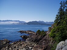
The Brooks Peninsula ( English Brooks Peninsula ) is a 14 km long, rocky peninsula on the west coast of Vancouver Island , northwest of Kyuquot . It separates Brooks Bay in the north from Checleset Bay in the south. The region is considered to be one of the stormiest along the coast.
The peninsula is the only part of Vancouver Island that has never been under glaciers. Therefore it has an unusual geological structure and flora and fauna also have numerous peculiarities.
The provincial park
The 51,631 ha M q uq w in / Brooks Peninsula Provincial Park (until 2009 Brookes Peninsula Provincial Park ) covers practically the entire peninsula. It is characterized by a wild coast, fjords reaching deep into the country and primeval forests. The highest mountain is the Snowsaddle Mountain with 1143 m , then there are the Klaskish Peak ( 963 m ), the Nunatak ( 930 m ) and the Doom Mountain ( 787 m ). To the east of the park, the mountains rise to over 2100 m .
There are extensive areas of "old forest" on the peninsula, i.e. forest not yet affected by logging ( old-growth forest ). The rare Marmelalk , which prefers old forests, is native here.
Much like the nearby Checleset Bay Ecological Reserve , the park offers a refuge for otters who were almost extinct in British Columbia by 1920. 1969–1972 they were resettled here from Alaska , so that today more than 2000 animals are expected again. There is limited fishing west of the coast.
The park is not accessible to motorized vehicles. Camping is allowed, but there is no infrastructure whatsoever. The few visitors come from Quatsino Sound in the north or Kyuquot Sound in the south. You can also charter boats and seaplanes in Kyuquot and Zeballos .
The park is located in the tribal area of the Kyuquot-Cheklesahht and the Quatsino First Nation.
The original recreation area of just 28,780 hectares was established in 1986, but upgraded to a class A provincial park in 1995, to which the 22,851 hectare Brooks-Nasparti region was added. This area includes the drainage area of the Nasparti River and other streams that flow into the Johnson Lagoon. Then there are the coasts at Nasparti Inlet, the Power River and the Battle Creek and the Mount Seaton area. The Battle Bay is not called that by chance, because several battles were actually fought here.
The Lois Property (33 hectares) east of the park may have low gold deposits. It is located 18 km southwest of Port Alice. As early as 1960 prospecting was carried out here in vain . Around 1975 the area was abandoned. Gold Leaf Ventures Inc. has been searching here since 1988.
The nearby Solander Island is an ecological reserve and not accessible. The areas south of the park are also only accessible after contacting the local First Nations .
Internet media
Web links
- Site of the Brooks Peninsula / Muquin Provincial Park
- Brooks Peninsula in the Canadian Mountain Encyclopedia
- Endangered Primeval Forests: East Creek Valley on Vancouver Island
Coordinates: 50 ° 8 ′ 23 ″ N , 127 ° 47 ′ 0 ″ W.


