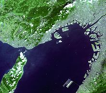
Osaka Bay
Coordinates: 34 ° 30 ′ 0 ″ N , 135 ° 9 ′ 0 ″ E
The Osaka Bay ( jap. 大阪湾 , Osaka-wan ) is a bay in western Japan . As the easternmost part of the Seto Inland Sea , it is separated from the Pacific by the Kii Channel to the south and from the rest of the Inland Sea by the Akashi Strait to the west .
The west coast is from the island of Awaji formed in the north and east, the limit prefectures Hyogo , Osaka and Wakayama Bay. The Tomogashima archipelago , which lies across the strait of the Kii Channel, is part of the Seto Inland Sea National Park .
The Bay of Osaka is the second largest metropolitan area in the country, the Kansai , and is widely used for shipping traffic. Numerous ports are used for handling goods and transporting people; the largest are those of Osaka, Kobe and Sakai . Numerous artificial islands have been created since the 1960s, including Port Island , Rokkō Island and the airport islands for Kansai Airport and Kobe Airport .

