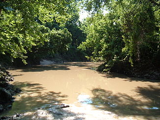
Buffalo bayou
| Buffalo bayou | ||
|
Map of the catchment area of the Buffalo Bayou |
||
| Data | ||
| Water code | US : 1372802 | |
| location | Texas , United States | |
| River system | San Jacinto River | |
| Drain over | San Jacinto River → Gulf of Mexico | |
| source | in Fort Bend County at Katy 29 ° 46 ′ 4 ″ N , 95 ° 49 ′ 32 ″ W |
|
| muzzle | in Harris County in the San Jacinto River Coordinates: 29 ° 45 ′ 50 " N , 95 ° 4 ′ 54" W 29 ° 45 ′ 50 " N , 95 ° 4 ′ 54" W
|
|
| length | 95 km | |
| Big cities | Houston , Texas | |
|
Buffalo Bayou near San Felipe and Memorial Drive in west Houston |
||
|
The confluence of Buffalo Bayou and White Oak Bayou at Allen's Landing |
||
The Buffalo Bayou is a 95 km long watercourse through Houston , Texas . It begins west of Houston at Katy on the northern edge of Fort Bend County to Waller County and flows east to the Houston Ship Channel . There are various large and small parks along its course. The water level of the bayou is regulated by the Barker Reservoir above the Barker Dam. The dam not only protects the city from flooding, but also serves to maintain a certain water level in the bayou.
course
From Barker Dam Bayou flows east of the Texas State Route 6 through, within the Terry Hershey Park , which the as from areas on both banks between Route 6 and Sam Houston Tollway known Beltway 8 is. Jogging, biking, and fishing are popular in this non-swimming area.
There is little bayou access between Beltway 8 and Loop 610 because the land along its banks in this section is privately owned.
East of Interstate 610, Buffalo Bayou flows through Memorial Park . A short distance below, the river is lined with Memorial Drive to the north and Allen Parkway to the south. From then on, the bayou flows through Downtown Houston , passing Allen's Landing , where the White Oak Bayou joins. From there to the confluence with the San Jacinto River , the bayou is under the influence of the tides. It has been dredged and forms part of the Houston Ship Channel .
history
The bayou is of vital importance in the history of Texas , not only because of the founding of the city of Houston, but also because of the Battle of San Jacinto that was fought on its banks near the confluence with the San Jacinto River. The outcome of this battle was critical to the independence of Texas from Mexico .
The original port of Houston was at the confluence of the Buffalo Bayou and White Oak Bayou in central Houston near the University of Houston-Downtown campus . This area is called Allen's Landing and is now a park. The area was the nucleus of the city of Houston. Numerous historical sites and ruins of old port facilities are still visible on the banks of the Buffalo Bayou today.
Despite the urban environment, the Buffalo Bayou and the parks around it are meeting points for residents during various festivities throughout the year. It is also popular with canoeists and kayak paddlers .
Web links
- Buffalo Bayou in the Handbook of Texas (English)
- Buffalo Bayou Partnership (English)
Individual evidence
- ^ Kemp, LW, & Kilman, E., The Battle of San Jacinto (and the San Jacinto Campaign) (1947) - presented on line by the Sons of DeWitt Colony Texas (McKeehan, WL, 1997-2006). Archive link ( Memento of the original from May 2, 2007 in the Internet Archive ) Info: The archive link was inserted automatically and has not yet been checked. Please check the original and archive link according to the instructions and then remove this notice.
- ↑ Kleiner, DJ, Allen's Landing , The Handbook of Texas Online (Texas State Historical Association, February 3, 2005).


