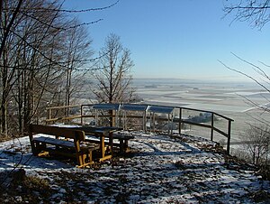
Erolzheim Castle
| Erolzheim Castle | |
|---|---|
| Alternative name (s): | Frohberg Castle |
| Castle type : | Höhenburg, spur location |
| Conservation status: | Burgstall |
| Place: | Erolzheim |
| Geographical location | 48 ° 5 '28 " N , 10 ° 4' 19" E |
The castle Erolzheim is an Outbound Spur castle . It was located on a spur hill 629 meters southwest of Erolzheim Castle near the municipality of Erolzheim in the Biberach district in Upper Swabia . Only the remains of moats and walls can be seen of the castle complex. The mountain chapel , a pilgrimage chapel , the hermitage and the burial place of the baronial family von Bernhard are located at the current location .
location
The castle lies above the Iller valley . From the third century AD, the Iller was part of the Danube-Iller-Rhein-Limes , a large-scale defense system of the Roman Empire, which was created after the abandonment of the Upper German-Raetian Limes .
